

Stibler-Weg (Nr. 8)
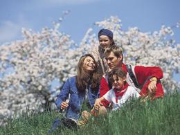

- Suitable for families
Interactive elevation profile
Create PDF
Tour-Details
Starting place: 5252 Aspach
Destination: 5252 Aspach
duration: 0h 58m
length: 3,8 km
Altitude difference (uphill): 32m
Altitude difference (downhill): 36m
Lowest point: 424m
Highest point: 463m
difficulty: medium
condition: medium
panoramic view: Individual Views
Paths covering:
Hiking trail
powered by TOURDATA
From the Kneipp spa house in the direction of Migelsbach (right) to former joinery Huber - turn left on a meadow path - about 300 m - field path right to the Stibler linden tree on the hill (rest bench, very nice view of Aspach) - a few meters in a westerly direction - then downhill in a southerly direction - meadow path to the goods road to Migelsbach (chapel) - turn right onto the goods road Niederham - Uberl chapel - shortly after turn right onto a meadow path - keep left - large oak tree - along the stream (path no. 2) back to the Kneipp spa house
2nd variant: from the oak tree directly to the main road Aspach/Höhnhart
2nd variant: from the oak tree directly to the main road Aspach/Höhnhart

Doppelrelaxliege
- Suitable for groups
- Suitable for friends
- Suitable for couples
- Suitable for children
- Spring
- Summer
- Autumn
- Early winter
Please get in touch for more information.
Marktplatz 9
5252 Aspach
Phone +43 7755 7355
Fax machine +43 7755 7355 - 4
E-Mail info@aspach.at
Web www.aspach.at
http://www.aspach.at
Interactive elevation profile
Create PDF
Tour-Details
Starting place: 5252 Aspach
Destination: 5252 Aspach
duration: 0h 58m
length: 3,8 km
Altitude difference (uphill): 32m
Altitude difference (downhill): 36m
Lowest point: 424m
Highest point: 463m
difficulty: medium
condition: medium
panoramic view: Individual Views
Paths covering:
Hiking trail
powered by TOURDATA