

Anton-Kolbauer-Weg
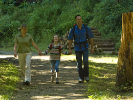


- Suitable for families
- Flatly
Interactive elevation profile
Create PDF
Tour-Details
Starting place: 5252 Aspach
Destination: 5252 Aspach
duration: 1h 9m
length: 4,4 km
Altitude difference (uphill): 42m
Altitude difference (downhill): 39m
Lowest point: 430m
Highest point: 464m
difficulty: medium
condition: medium
panoramic view: Individual Views
Paths covering:
Hiking trail
powered by TOURDATA
From the spa house on the main road in the direction of Mettmach - cemetery - Radlgrabenwald - village Dösenbach - over the bridge - in the sharp right turn left onto the field path - Pumperhölzl (possibility to Hub, right, path no. 12) - continue to Döging - return to Aspach via E.-Daringer-Weg (no. 5) over the Bennal-Höhe or via the main road - Katzlberg (chapel) - Aspach
- Suitable for seniors
- Suitable for friends
- Suitable for children
- Spring
- Summer
- Autumn
Please get in touch for more information.
5252 Aspach
Phone +43 7755 7355
Fax machine +43 7755 7355 - 4
E-Mail info@aspach.at
Web www.aspach.at
http://www.aspach.at
Interactive elevation profile
Create PDF
Tour-Details
Starting place: 5252 Aspach
Destination: 5252 Aspach
duration: 1h 9m
length: 4,4 km
Altitude difference (uphill): 42m
Altitude difference (downhill): 39m
Lowest point: 430m
Highest point: 464m
difficulty: medium
condition: medium
panoramic view: Individual Views
Paths covering:
Hiking trail
powered by TOURDATA