

Nr. 312 Schweigertsreither


- Suitable for families
Interactive elevation profile
Create PDF
Tour-Details
Starting place: 5241 Maria Schmolln
Destination: 5241 Maria Schmolln
duration: 2h 44m
length: 9,3 km
Altitude difference (uphill): 231m
Altitude difference (downhill): 230m
Lowest point: 456m
Highest point: 560m
difficulty: medium
condition: medium
panoramic view: Individual Views
Paths covering:
Hiking trail
powered by TOURDATA
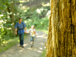
Enjoy the beautiful views along the path
Village square - old people's home - Stations of the Cross - at the Bubesting crossroads in the direction of Braunau am Inn and Haslau - Bucheck - inn in Putting - 50 m back - after the chapel continue to the inn in Schweigertsreith - Hubertus Chapel - Maria Schmolln
Village square - old people's home - Stations of the Cross - at the Bubesting crossroads in the direction of Braunau am Inn and Haslau - Bucheck - inn in Putting - 50 m back - after the chapel continue to the inn in Schweigertsreith - Hubertus Chapel - Maria Schmolln
- Suitable for groups
- Suitable for friends
- Suitable for couples
- Spring
- Summer
- Autumn
- Early winter
Please get in touch for more information.
5241 Maria Schmolln
Phone +43 7743 2255
Fax machine +43 7743 2255 - 4
E-Mail gemeinde@maria-schmolln.ooe.gv.at
Web www.maria-schmolln.at
http://www.maria-schmolln.at
Interactive elevation profile
Create PDF
Tour-Details
Starting place: 5241 Maria Schmolln
Destination: 5241 Maria Schmolln
duration: 2h 44m
length: 9,3 km
Altitude difference (uphill): 231m
Altitude difference (downhill): 230m
Lowest point: 456m
Highest point: 560m
difficulty: medium
condition: medium
panoramic view: Individual Views
Paths covering:
Hiking trail
powered by TOURDATA