

Nr. 315 Schnellberger
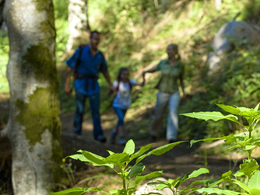


- Suitable for families
Interactive elevation profile
Create PDF
Tour-Details
Starting place: 5241 Maria Schmolln
Destination: 5241 Maria Schmolln
duration: 2h 49m
length: 9,1 km
Altitude difference (uphill): 296m
Altitude difference (downhill): 296m
Lowest point: 471m
Highest point: 595m
difficulty: medium
condition: medium
panoramic view: Individual Views
Paths covering:
Hiking trail
powered by TOURDATA
Village square - crossing Bubestinger - outdoor swimming pool with Kneipp pedal facility - next crossing right onto the hill - crossing the Hausruck long distance hiking trail - Unterschnellberg hill - Ebnerwirt inn - after approx. 200 m right along the forest path - in the forest approx. 2 km uphill - on the hilltop left - road Aicheck - at the main road "Totenmann" cross the road - through forest downhill into Moosbachtal - path Minathal to Unterminathal - Maria Schmolln
- Suitable for friends
- Suitable for couples
- Spring
- Summer
- Autumn
- Early winter
Please get in touch for more information.
5241 Maria Schmolln
Phone +43 7743 2255
Fax machine +43 7743 2255 - 4
E-Mail gemeinde@maria-schmolln.ooe.gv.at
Web www.maria-schmolln.at
http://www.maria-schmolln.at
Interactive elevation profile
Create PDF
Tour-Details
Starting place: 5241 Maria Schmolln
Destination: 5241 Maria Schmolln
duration: 2h 49m
length: 9,1 km
Altitude difference (uphill): 296m
Altitude difference (downhill): 296m
Lowest point: 471m
Highest point: 595m
difficulty: medium
condition: medium
panoramic view: Individual Views
Paths covering:
Hiking trail
powered by TOURDATA