

Kulturweg


- pets allowed
- culturally interesting
- Flatly
Interactive elevation profile
Create PDF
Tour-Details
Path number: Hi9
Starting place: 4242 Hirschbach im Mühlkreis
Destination: 4242 Hirschbach im Mühlkreis
duration: 2h 5m
length: 6,7 km
Altitude difference (uphill): 240m
Altitude difference (downhill): 142m
Lowest point: 632m
Highest point: 790m
difficulty: medium
condition: medium
panoramic view: Great panorama
Paths covering:
Hiking trail
powered by TOURDATA
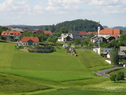
On the way is the Hirschbach parish church with the largest Easter candlestick and the Waldburg parish church with its world-famous winged altars!
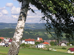
Via Kirchberg and the "Luag" viewing point (781m) to Harruck and Waldburg.
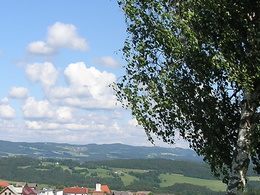
Beautiful views of the northern and eastern Mühlviertel.
Back via Marreith (Groissnbauer) and Kirchberg to Hirschbach-Ort.
Alternative: from Kirchberg via Auerbach and Grünbrunn (St Mary's Chapel) to Hirschbach-Ort, on the Hi 2 musicians' trail.
Via Kirchberg and the "Luag" viewing point (781m) to Harruck and Waldburg.
Beautiful views of the northern and eastern Mühlviertel.
Back via Marreith (Groissnbauer) and Kirchberg to Hirschbach-Ort.
Alternative: from Kirchberg via Auerbach and Grünbrunn (St Mary's Chapel) to Hirschbach-Ort, on the Hi 2 musicians' trail.
Parking
- Parking space: 20
- Bus parking space: 1
- Suitable for groups
- Suitable for schools
- Pets allowed
- Spring
- Summer
- Autumn
Please get in touch for more information.

Museumsweg 6
4242 Hirschbach im Mühlkreis
Phone +43 7948 55895
E-Mail info@kraeuterkraftquelle.at
Web www.kraeuterkraftquelle.at
http://www.kraeuterkraftquelle.at
Interactive elevation profile
Create PDF
Tour-Details
Path number: Hi9
Starting place: 4242 Hirschbach im Mühlkreis
Destination: 4242 Hirschbach im Mühlkreis
duration: 2h 5m
length: 6,7 km
Altitude difference (uphill): 240m
Altitude difference (downhill): 142m
Lowest point: 632m
Highest point: 790m
difficulty: medium
condition: medium
panoramic view: Great panorama
Paths covering:
Hiking trail
powered by TOURDATA