

Genussrunde Nr. 914


- culinary interesting
- culturally interesting
- Flatly
- Possible accommodation
Interactive elevation profile
Create PDF
Tour-Details
Path number: 914
Starting place: 4232 Hagenberg im Mühlkreis
Destination: 4232 Hagenberg im Mühlkreis
duration: 1h 36m
length: 20,6 km
Altitude difference (uphill): 319m
Altitude difference (downhill): 319m
Lowest point: 364m
Highest point: 557m
difficulty: easy
condition: easy
panoramic view: Some Views
Paths covering:
Asphalt
powered by TOURDATA
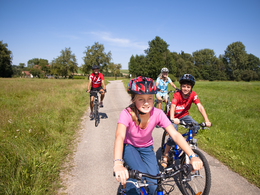
We start in the centre of Hagenberg. Several restaurants can be visited here. Those interested in technology can get information about the Hagenberg University Community Software Park at the INFO Point. The castle chapel with the castle park is also worth a visit. The Happy Bike hire station is located in the centre of the village, next to the primary school. After a pleasant stop in the centre of Hagenberg, we leave the centre on the main road. The ride now takes us out of the town centre into the Veichterwald forest and after a short climb we reach the Mahrersdorf junction. From here, the route descends past the Grüner snack station into the Aisttal valley and crosses the Aist at the Leitner smithy to join the cycle path network of the municipality of Pregarten. The next village you pass through is Selker, where you can enjoy a refreshment stop at the Eder Bräu beer tavern. (e-bike charging station) The route continues along the old Gutauer Landstraße past Kriechmayrdorf and Pregartsdorf. The Hubertus Chapel at the elevated reservoir and the wonderful view of Pregarten invite you to take a short break. We now cycle along the goods road towards Halmenberg, past the Greisingberg to Greising. Along Peyerl-Straße up to Unionberg you come to Parkstraße. Here you can visit the neo-Gothic parish church of St Anna. From Parkstraße, the route continues along Schulstraße past the Pregarten primary school. The route continues along Gutauer Straße to the Pregarten town square. The staff at the INFO centre in the town hall look forward to your visit.
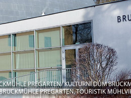
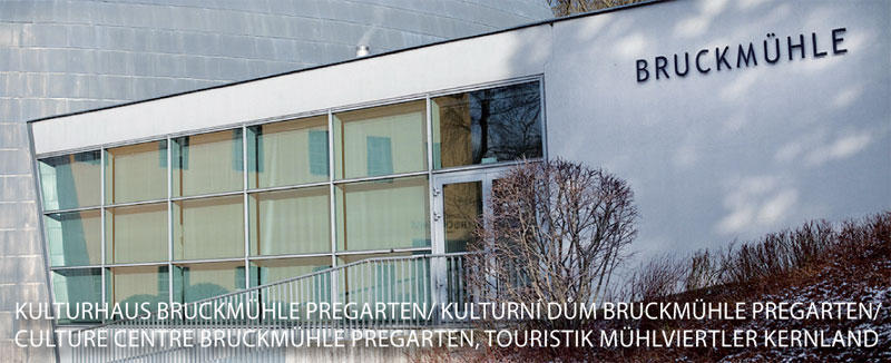
You can recharge your e-bike at the charging station at the Bruckmühle cultural centre.
E-bike hire stations: Eder Bräu and Bruckmühle
You can recharge your e-bike at the charging station at the Bruckmühle cultural centre.
E-bike hire stations: Eder Bräu and Bruckmühle

")


")
Most economical season
- Spring
- Summer
- Autumn
Please get in touch for more information.
Stadtplatz 12
4230 Pregarten
Phone +43 7236 2255
E-Mail Stadtamt@pregarten.ooe.gv.at
Web www.muehlviertel-urlaub.at/rad
http://www.muehlviertel-urlaub.at/rad
Interactive elevation profile
Create PDF
Tour-Details
Path number: 914
Starting place: 4232 Hagenberg im Mühlkreis
Destination: 4232 Hagenberg im Mühlkreis
duration: 1h 36m
length: 20,6 km
Altitude difference (uphill): 319m
Altitude difference (downhill): 319m
Lowest point: 364m
Highest point: 557m
difficulty: easy
condition: easy
panoramic view: Some Views
Paths covering:
Asphalt
powered by TOURDATA