

Blumauer Alm


- Flatly
Interactive elevation profile
Create PDF
Tour-Details
Starting place: 4591 Molln
Destination: 4591 Molln
duration: 4h 19m
length: 44,7 km
Altitude difference (uphill): 305m
Altitude difference (downhill): 306m
Lowest point: 428m
Highest point: 724m
difficulty: easy
condition: easy
panoramic view: Some Views
Paths covering:
Asphalt, Path / trail, Gravel, Other
powered by TOURDATA
Short description:
Molln - Breitenau - Bodinggraben - Blumauer Alm - return same route
Molln - Breitenau - Bodinggraben - Blumauer Alm - return same route
Recommended season:
- April
- May
- June
- July
- August
- September
- October
Properties:
- Loop
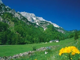
An easy bike tour in the most beautiful valley head of the Kalkalpen National Park.
Directions:
You start at the NPZ in Molln and cycle on the Breitenauerstraße past the GH Steiner Kraml and later the GH Windhager-Kores. At km 12 you cross the Seebach bridge over the Krumme Steyrling. You will now reach colorful daffodil, orchid and gentian meadows, which show themselves in all their splendor from the end of May until July. After 17.6 km you reach the Scheiblingau parking lot, which is the starting point for further bike tours, and after 20 km the trail leads you past the Jagahäusl and the former hunting lodge of the county of Lamberg. At km 23 you have reached the destination of your tour, the barrier to the Blumauer Alm. Wild animals and grazing cattle have priority over humans. You will be compensated for this with a pleasant view of the Blumauer Alm and the magnificent mixed mountain forests. After a hearty snack at the Jagahäusl, you can cycle back to Molln along the same route.
Safety guidelines:
Inquire in advance about any trail or road closures along the route.
Equipment:
Sun and rain protection, repair kit for minor bike breakdowns.
Additional information:
You can obtain up-to-date map material at www.steyr-nationalpark.at
Starting point: Nationalpark Zentrum Molln
Destination: Nationalpark Zentrum Molln
further information:
- Flatly
details mountainbike
- Riding technique: easy
- Suitable for teenagers
- Suitable for seniors
- Suitable for single travelers
- Suitable for friends
- Suitable for couples
- Spring
- Summer
- Autumn
Please get in touch for more information.
Stadtplatz 27
4400 Steyr
Phone +43 7252 53229 - 0
E-Mail reichraming@steyr-nationalpark.at
Web www.steyr-nationalpark.at/
https://www.steyr-nationalpark.at/
Interactive elevation profile
Create PDF
Tour-Details
Starting place: 4591 Molln
Destination: 4591 Molln
duration: 4h 19m
length: 44,7 km
Altitude difference (uphill): 305m
Altitude difference (downhill): 306m
Lowest point: 428m
Highest point: 724m
difficulty: easy
condition: easy
panoramic view: Some Views
Paths covering:
Asphalt, Path / trail, Gravel, Other
powered by TOURDATA