

Alm-Panorama-Radroute Nr. 943


Interactive elevation profile
Create PDF
Tour-Details
Path number: 943
Starting place: 4280 Königswiesen
Destination: 4272 Weitersfelden
duration: 1h 48m
length: 18,7 km
Altitude difference (uphill): 606m
Altitude difference (downhill): 739m
Lowest point: 602m
Highest point: 890m
difficulty: medium
condition: medium
panoramic view: Great panorama
Paths covering:
Asphalt
powered by TOURDATA
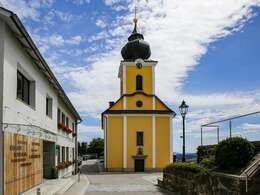
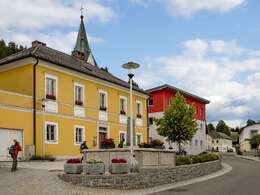
The cycle route starts in Königswiesen and leads via Unterweißenbach, Kaltenberg, Nabelbach and ends in Weitersfelden. The connecting route is signposted on both sides.
- Suitable for single travelers
- Suitable for friends
- Suitable for couples
- Spring
- Summer
- Autumn
Please get in touch for more information.
Markt 22
4280 Königswiesen
Phone +43 7955 6255
E-Mail marktgemeinde@koenigswiesen.ooe.gv.at
Web www.koenigswiesen.at/
Web www.muehlviertel-urlaub.at/rad
https://www.koenigswiesen.at/
http://www.muehlviertel-urlaub.at/rad
http://www.muehlviertel-urlaub.at/rad
Interactive elevation profile
Create PDF
Tour-Details
Path number: 943
Starting place: 4280 Königswiesen
Destination: 4272 Weitersfelden
duration: 1h 48m
length: 18,7 km
Altitude difference (uphill): 606m
Altitude difference (downhill): 739m
Lowest point: 602m
Highest point: 890m
difficulty: medium
condition: medium
panoramic view: Great panorama
Paths covering:
Asphalt
powered by TOURDATA