

Gahberg - Hongar


- pets allowed
- Suitable for families
- Suitable for kids (all ages)
Interactive elevation profile
Create PDF
Tour-Details
Starting place: 4852 Weyregg am Attersee
Destination: 4852 Weyregg am Attersee
duration: 2h 7m
length: 6,8 km
Altitude difference (uphill): 235m
Altitude difference (downhill): 196m
Lowest point: 825m
Highest point: 970m
difficulty: medium
condition: medium
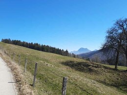
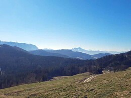
panoramic view: Great panorama
Paths covering:
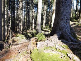
Asphalt, Hiking trail
powered by TOURDATA
We start our hike at the parking lot in front of the Gahbergkapelle.
We pass on the Gahbergstraße to the chapel and then walk up to a barrier. Here we follow the signs to Hongar / Kreuzing (approx. 2 hours). We walk along a ridge through forests and meadows gently uphill. The way back is back on the same route or via the Kreuzing-Alm to the Gahbergkapelle.
Refreshments:
Alpengasthof Kogler - Tel. +43 7664 2258
Kreuzing Alm - Tel. +43 7664 20777
Almgasthaus Schwarz - Tel. +43 7664 2012
")
")
Parking
- Parking space: 5
- Suitable for groups
- Suitable for schools
- Suitable for kids (all ages)
- Pets allowed
- Suitable for teenagers
- Suitable for seniors
- Suitable for single travelers
- Suitable for friends
- Suitable for couples
- Suitable for children
- Spring
- Summer
- Autumn
Please get in touch for more information.
Weyreggerstraße 69
4852 Weyregg am Attersee
Phone +43 7666 7719 - 70
E-Mail info.weyregg@attersee.at
Web attersee-attergau.salzkammergut.at
https://attersee-attergau.salzkammergut.at
You can also visit us on
Visit us on Facebook Visit our videochannel on YouTube WikipediaInteractive elevation profile
Create PDF
Tour-Details
Starting place: 4852 Weyregg am Attersee
Destination: 4852 Weyregg am Attersee
duration: 2h 7m
length: 6,8 km
Altitude difference (uphill): 235m
Altitude difference (downhill): 196m
Lowest point: 825m
Highest point: 970m
difficulty: medium
condition: medium
panoramic view: Great panorama
Paths covering:
Asphalt, Hiking trail
powered by TOURDATA