

Vom Offensee zum Rinnerkogel und Wildensee


- Flatly
Interactive elevation profile
Create PDF
Tour-Details
Starting place: 4802 Ebensee
Destination: 4802 Ebensee
duration: 8h 57m
length: 16,9 km
Altitude difference (uphill): 1.516m
Altitude difference (downhill): 1.508m
Lowest point: 649m
Highest point: 1.983m
difficulty: difficult
condition: difficult
panoramic view: Great panorama
Paths covering:
Hiking trail
powered by TOURDATA
Demanding mountain tour with exposed and secured sections; do not go in fog or snow!
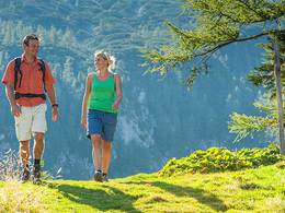
High above the Offensee lake, the Tote Gebirge mountains show themselves from their liveliest side: larches and stone pines conjure up a true park atmosphere, mountain water gurgles through a miniature gorge between gentian and alpine bushes and, finally, the remote Wildensee lake glistens in the sun. You could stroll through this little paradise for hours, but after all, there is always a cosy mountain hut to stop off at. If you want to get a bird's eye view of all this and also experience the karstic peaks of the Totes Gebirge, climb the rocky and lonely Rinnerkogel - the distant view from the summit is definitely worth the sweat. From the car park at Offensee, we follow the forest road along the eastern shore. Always following trail marker 212 and the signposts to the "Rinnerhütte", you reach the Moosbründl at the head of the Seeau valley. The path soon becomes steeper and winds its way up the steep slope next to the waterfall wall via countless hairpin bends and steps. Via an aluminium staircase to the Rinnerboden (spring), then through a scree slope and a gently ascending high valley to the Rinnerhütte (Rinnerstüberl). Continue alongside the stream until the path forks: Straight ahead you reach a rocky saddle, behind which lies the hollow with the small Wildensee lake. In the saddle, path 231 branches off to the right towards Rinnerkogel. It soon meets the path that leads directly up from the Rinnerboden and on which we climb to the left to the Rosskogelgrube. Continue in steep hairpin bends and between mountain pines and sinkholes to the Rinnersattel, turn right there and cross the stony western slope to the summit cross. The descent follows the same route.Rest stops:
Restaurant and snack station at Offensee, Rinnerhütte
Most economical season
- Spring
- Summer
- Autumn
Please get in touch for more information.
Totes Gebirge
4802 Ebensee
Phone +43 6133 8016
E-Mail ebensee@traunsee-almtal.at
Web www.traunsee-almtal.at/ebensee
http://www.traunsee-almtal.at/ebensee
Interactive elevation profile
Create PDF
Tour-Details
Starting place: 4802 Ebensee
Destination: 4802 Ebensee
duration: 8h 57m
length: 16,9 km
Altitude difference (uphill): 1.516m
Altitude difference (downhill): 1.508m
Lowest point: 649m
Highest point: 1.983m
difficulty: difficult
condition: difficult
panoramic view: Great panorama
Paths covering:
Hiking trail
powered by TOURDATA