Marktwald - Gahberg - Marktwald
Starting place: 4861 Schörfling am Attersee
Destination: 4861 Schörfling am Attersee
Dorfstraße 33
4865 Nußdorf am Attersee
4865 Nußdorf am Attersee

This varied walk takes us to the Gahberg where we enjoy a magnificent panorama.
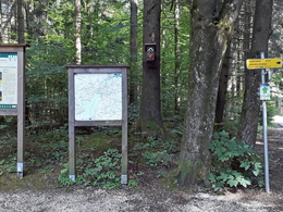
The starting point for this hike is at the parking lot in the market forest road. From there we walk to the market along the forest road to the forestry road. We turn right and then walk about 100 meters uphill. At the next junction bear left and continue to the next junction.This is then left to the end of the forest road. There we cross the bridge and come to the "Geiner". Now we continue our trek continues on the right hand Forststra & e until we focus on the next fork left. After about 500 meters we reach the table "water reserve". 100 m further, turn right and walk on the Gahberg whose goal we reached in about 30 minutes. There we can enjoy beautiful views before we return by the same route back to the starting point.
On the way there is no catering possibility we recommend taking a snack and drinks.
Starting place: 4861 Schörfling am Attersee
Destination: 4861 Schörfling am Attersee
duration: 2h 39m
length: 8,5 km
Altitude difference (uphill): 284m
Altitude difference (downhill): 272m
Lowest point: 533m
Highest point: 844m
difficulty: medium
condition: medium
panoramic view: Individual Views
Paths covering:
Hiking trail
Starting point: parking lot Marktwaldstraße
Destination: Gahberg
further information:
- Board possible
Accessibility / arrival
Starting point Marktwald
- Parking space: 20
- All weather
- Suitable for groups
- Suitable for schools
- Pets allowed
- Suitable for teenagers
- Suitable for seniors
- Suitable for single travelers
- Suitable for families
- Suitable for friends
- Suitable for couples
- Suitable for children
- Spring
- Summer
- Autumn
- Early winter
Not suitable for wheelchairs. The property is not compliant with Austria's ÖNORM legal standard.
Dorfstraße 33
4865 Nußdorf am Attersee
Phone +43 7666 7719 - 0
Fax machine +43 7666 7719 - 19
E-Mail info.schoerfling@attersee.at
Web attersee-attergau.salzkammergut.at
https://attersee-attergau.salzkammergut.at
You can also visit us on
Facebook YouTube Wikipedia


