Hoh-Haus am Buchberg Rundweg
Starting place: 4291 Lasberg
Destination: 4291 Lasberg
Markt 26
4291 Lasberg
4291 Lasberg

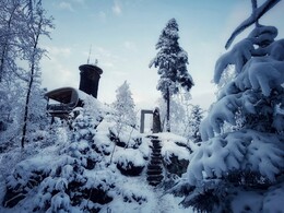
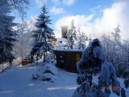
A winter hike to the "Hoh Haus" viewing platform on the Buchberg is a truly special experience. Easy to hike with normal hiking equipment, snowshoes, touring skis or cross-country skis. (Tip for children: take a toboggan or sled with you - the ride down is certainly more fun!)
Markt Lasberg, PP at the ASZ, WW La 8 to the Buchberg;
Gh. Stadler, railway station Lasberg/St.Osw., WW La/5/8/9 via Siegelsdorf to the Buchberg;
Gh. Elzer Stube, Elz 1, WW La 8 to the Buchberg
or Schloss Weinberg, WW 170 to the Buchberg
In 1 hour walking time you reach the Hoh Haus.
Enjoy the view of the heartland from the viewing platform. Stop off at the Buchberghütte, which is open on Saturdays, Sundays and public holidays from 10 am to 6 pm. Or at the inn at the starting point.
Depending on your fitness level: Large Lasberg circular trail, WWLa 7 to the Braunberg and WW 170 to the Buchberg, WW La 8 to Lasberg. Circular route Buchberg - Elz (La 8) or short circular route via Grieb La 8, 170, La 8, La 10) possible.
Starting place: 4291 Lasberg
Destination: 4291 Lasberg
duration: 3h 8m
length: 9,6 km
Altitude difference (uphill): 376m
Altitude difference (downhill): 377m
Lowest point: 480m
Highest point: 814m
difficulty: medium
condition: medium
panoramic view: Some Views
Paths covering:
Asphalt, Hiking trail
Starting point: The starting points for a hike to the Hoh-Haus am Buchberg are in the village of Lasberg, at the "Zur Haltestelle" hiking inn in Siegelsdorf, at the Sepp`n Wirt inn in Elz or at the Schlossbrauerei Weinberg brewery in Kefermarkt.
Destination: Lasberg (railway station)
further information:
- Flatly
- Possible accommodation
- Board possible
Details - hiking
- cleared winter hiking path
Accessibility / arrival
Take the railway directly to the start. Get off at Lasberg-St.Oswald.
By car you have to drive to the inn "Zur Haltestelle", owner Erika Stadler, Siegelsdorf 21, 4291 Lasberg. There you will also find plenty of parking spaces.
- All weather
- Suitable for groups
- Suitable for schools
- Suitable for kids (6 - 10 Year)
- Pets allowed
- Suitable for families
- Spring
- Summer
- Autumn
- Early winter
Not suitable for wheelchairs. The property is not compliant with Austria's ÖNORM legal standard.
Markt 26
4291 Lasberg
Phone +43 7947 7255 - 13
mobile +43 677 64764733
E-Mail www.tourismuskern@lasberg.at
Web www.buchberg-hoh-haus.at/
Web www.lasberg.at
http://www.buchberg-hoh-haus.at/
http://www.lasberg.at
http://www.lasberg.at
You can also visit us on
Wikipedia


