Romantiktal-Weg
Starting place: 4372 Pabneukirchen
Destination: 4372 Pabneukirchen

Qualified certified hiking trail - Austrian Hiking Seal of Quality
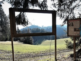
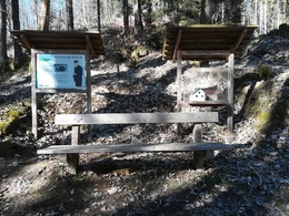
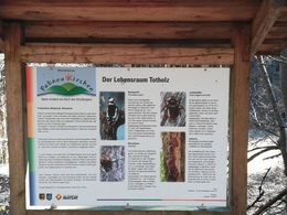
"Searching for traces of an abandoned homeland"The hiking trail begins and ends in the centre of Pabneukirchen. The distance is approx. 8 km and the walking time approx. 3 hours. The hiking trail leads from the market square via Kellergasse past the outdoor pool towards the Klingenberg ruins to the Pabneukirchen-St. Thomas am Blasenstein municipal boundary. Continue north along the gravel path - past the remains of abandoned smallholdings. The hiking trail leads through marvellous natural landscapes accompanied by wet meadows with rare vegetation and through natural forests, some of which have a primeval forest character. Information boards provide information about the unique flora and fauna as well as the history of the abandoned smallholdings. Rest benches invite you to linger in romantic places. At the highest point of the hiking trail is the riding farm and the Heimelsteiner snack station. From there you have a marvellous view over the wild and romantic valley of the Maseldorfer Bach stream to the Klingenberg ruins and across the Danube region. After the Heimelsteiner snack station, the trail continues southwards back to Pabneukirchen.
Accessibility / arrival
by car:
From the Salzburg/Linz area:
Linz - B3 to Perg - Münzbach - Pabneukirchen
/ or Linz - A1 Enns - Mauthausen - B3 to Perg - Münzbach - Pabneukirchen.
From Vienna:
A1 Westautobahn to Amstetten - Grein/Danube -
Bad Kreuzen - Pabneukirchen / or
A1 Westautobahn to Ybbs - Donaubrücke - B3 to Grein - Bad Kreuzen - Pabneukirchen.
From the direction of Freistadt:
Freistadt - Pregarten - Tragwein - Bad Zell - Pierbach - Mönchdorf - Pabneukirchen.
By train:
Westbahn to Linz - Donauuferbahn to Grein - by taxi or bus to Pabneukirchen
Most economical season
- Spring
- Summer
- Autumn
Please get in touch for more information.
4372 Pabneukirchen
Phone +43 7265 5255 - 0
E-Mail gemeinde@pabneukirchen.ooe.gv.at
Web www.pabneukirchen.at
http://www.pabneukirchen.at


