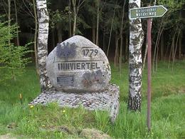
Historischer Wanderweg
Starting place: 4762 St. Willibald
Destination: 4762 St. Willibald
Brief description:
The hiking trail was built in 1978 and presents the eventful history of the parish of St Willibald in seven stations. The trail starts at the vicarage, is well signposted, family-friendly and can also be walked in sections. Many benches invite you to take a cosy break.
Information and brochures are available at the municipal office or by calling 07762/2900 or 0664/5166641. Guided tours are also available.
Route:
St. Willibald - B 129 - St. Jakob - Römerstraße - Rothmaierberg - St. Willibald
Description:
The hiking trail is 14 kilometres long. It starts in the village of St. Willibald at the vicarage, leads along the B 129 via the Salletwald forest to St. Jakob (Antlangkirchen) up to the Römerstraße and over the Rothmaierberg back to the starting point.
Most economical season
- Spring
- Summer
- Autumn
- Early winter
- Deep winter
Please get in touch for more information.
4762 St. Willibald
Phone +43 7762 2900
mobile +43 664 5166641
E-Mail info@sankt-willibald.at
Web www.sankt-willibald.at
http://www.sankt-willibald.at


