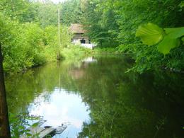
Mühlenweg
Starting place: 4760 Raab
Destination: 4760 Raab
Route:
Raab (school) - Maria Bründl - Riedlhof - Wetzlbach - Tautzham - Unterholzen - Kopfberg - Ursprung - Reinthal - Pausing - Raab
Description:
Starting at the school centre, the Mühlenweg trail leads via Moarhof and past the Bründlbach stream via Ameisleiten to Maria Bründl. You then come to the miller in Bründl. From there, the trail continues to Riedlhof, Wetzlbach, Gautzham, Unterholzen and Kopfberg.
This trail was named after the mills that used to be located along the Bründl and Raaber streams. Once you reach Ursprung, you can take a detour to the source of the Raaber Bach stream before returning to Raab via Reinthal and Pausing.
- Suitable for groups
- Suitable for schools
- Suitable for teenagers
- Suitable for seniors
- Suitable for single travelers
- Suitable for families
- Suitable for friends
- Suitable for couples
- Suitable for children
- Spring
- Summer
- Autumn
- Early winter
- Deep winter
Please get in touch for more information.
Marktstraße 7
4760 Raab
Phone +43 7762 2255
E-Mail gemeinde@raab.ooe.gv.at
Web www.raab.ooe.gv.at/system/web/sonde…
http://www.raab.ooe.gv.at/system/web/sonderseite.aspx?menuonr=219567021&detailonr=219567021


