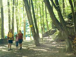
Ehersdorfer Rundweg, Variante A
Starting place: 5121 Tarsdorf
Destination: 5121 Tarsdorf
Ehersdorf circular route, variant A (yellow-white markings; length starting from the village square: approx. 4.3 kilometres)
From the village square, the municipal road leads to the "Gmui" district. After approx. 200 metres you reach a fork in the road where you turn left towards Eckldorf. Approximately 100 metres after the village sign for Eckldorf, turn right onto a gravel path. This runs alongside the quarry pond. At the end of the gravel path you reach Friedensplatz, after about 100 metres you cross Öllinger Straße and walk through the forest towards Ehersdorf. In Ehersdorf, turn right onto a meadow path towards the sports field and return to Tarsdorf.
From the village square, the municipal road leads to the "Gmui" district. After approx. 200 metres you reach a fork in the road where you turn left towards Eckldorf. Approximately 100 metres after the village sign for Eckldorf, turn right onto a gravel path. This runs alongside the quarry pond. At the end of the gravel path you reach Friedensplatz, after about 100 metres you cross Öllinger Straße and walk through the forest towards Ehersdorf. In Ehersdorf, turn right onto a meadow path towards the sports field and return to Tarsdorf.
- Suitable for kids (all ages)
- Suitable for pushchairs
- Suitable for teenagers
- Suitable for seniors
- Suitable for single travelers
- Suitable for families
- Suitable for friends
- Suitable for couples
- Suitable for children
- Spring
- Summer
- Autumn
- Early winter
Please get in touch for more information.
5121 Tarsdorf
Phone +43 6278 8103
E-Mail gemeinde@tarsdorf.ooe.gv.at
Web www.tarsdorf.at
http://www.tarsdorf.at


