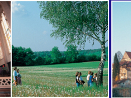
© Foto: Oberösterreich Tourismus GmbH/Robert Maybach: Gesellige Runde am Wolfgangsee
Gruppe junger Menschen auf einem Steg am Wolfgangsee

Pilgerweg VIA NOVA

  • Suitable for families
  • culinary interesting
  • culturally interesting
  • Multi-day tour

 Interactive elevation profile

Download GPS data
Create PDF

Tour-Details

Starting place: 4962 Mining
Destination: 5282 Braunau am Inn

duration: 3h 30m
length: 16,9 km
Altitude difference (uphill): 101m
Altitude difference (downhill): 92m

Lowest point: 337m
Highest point: 390m
difficulty: medium
condition: medium
panoramic view: Great panorama

Paths covering:
Asphalt, Gravel

powered by TOURDATA

THE LONGEST JOURNEY IS THE JOURNEY TO YOURSELF
The European pilgrimage route VIA NOVA in Bavaria, Austria and the Czech Republic.
This section of the pilgrimage trail begins at the Mattig crossing. We follow the yellow markings and walk past idyllic detached houses. The path continues to the pilgrimage church of St Valentin. With a view of the "Stechlweiher" pond, we follow the Haselbach footpath along the town stream until we enjoy the view of the Bürgerspitalkirche Hl. The path leads along the town stream at Vorderbad to Salzburger Vorstadt. Here we keep to the right and enter the town square through the gate tower, which is one of the most beautiful squares in the Inn-Salzach towns. At the end of J.-Fischer-Gasse is the bell foundry (14th century). We pass the Braunau district museum, the "Herzogsburg", and our gaze falls on the parish church of St. Stephan, a mighty 15th century stepped hall church. Following the markings, we pass the Augenbründl "Hergott im Thal", next to lime trees that are over 300 years old. We walk along a footpath past the water tower to Ranshofen Castle Park with its convent garden. Finally we see the parish church of St Pankratius on the right. This church was a collegiate church of the Augustinian canons until the monastery was dissolved in 1811. The path takes us past the Gierlinger inn and the Putscher inn, where we turn left onto a footpath that leads to the Inndamm dam and on to the Ratzlburg castle.

further information:
  • culinary interesting
  • Multi-day tour

Details - hiking
  • themed path
Travelling by public transport
Route planner for independent travellers
  • Suitable for groups
Most economical season
  • Spring
  • Summer
  • Autumn

Please get in touch for more information.


Pilgerweg VIA NOVA
Tourismusverband Entdeckerviertel
Theatergasse 3
5280 Braunau am Inn

Phone +43 7722 62644
E-Mail info@entdeckerviertel.at
Web www.pilgerweg-vianova.eu/
https://www.pilgerweg-vianova.eu/

We speak the following languages

German

 Interactive elevation profile

Download GPS data
Create PDF

Tour-Details

Starting place: 4962 Mining
Destination: 5282 Braunau am Inn

duration: 3h 30m
length: 16,9 km
Altitude difference (uphill): 101m
Altitude difference (downhill): 92m

Lowest point: 337m
Highest point: 390m
difficulty: medium
condition: medium
panoramic view: Great panorama

Paths covering:
Asphalt, Gravel

powered by TOURDATA