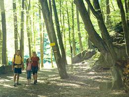
Schneiderbauernhöhenweg 2,5 bzw. 2 km
Starting place: 4722 Peuerbach
Destination: 4722 Peuerbach
This trail forms the link between the Leithentalweg, the Alm-Mühlen-Weg and the Urtl-Weg. It also leads past the highest point in Peuerbach, the Schneiderbauerhöhe at 537 metres, and through one of the most beautiful landscapes in the municipality, the Leithen. Use it to vary the routes indicated to suit your own taste.
- Suitable for groups
- Suitable for schools
- Suitable for teenagers
- Suitable for seniors
- Suitable for single travelers
- Suitable for families
- Suitable for friends
- Spring
- Summer
- Autumn
Not suitable for wheelchairs. The property is not compliant with Austria's ÖNORM legal standard.
4722 Peuerbach
Phone +43 7276 2255 - 203
E-Mail stadt@peuerbach.ooe.gv.at
Web www.peuerbach.at
https://www.peuerbach.at


