Bajuwaren-Radtour
- culturally interesting
- Flatly
Interactive elevation profile
Create PDF
Tour-Details
Starting place: 5131 Franking
Destination: 5131 Franking
duration: 8h 49m
length: 125,3 km
Altitude difference (uphill): 996m
Altitude difference (downhill): 1.000m
Lowest point: 372m
Highest point: 623m
difficulty: medium
condition: medium
panoramic view: Great panorama
Paths covering:
Asphalt, Street, Other
powered by TOURDATA
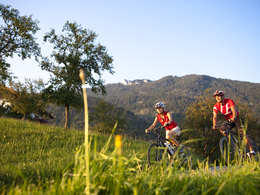
The 120 km long Bajuwaren Tour connects the Waginger See-Salzachtal and Salzburger Seenland regions. The family-friendly cycle route leads away from the main roads, along asphalted country and local roads or designated cycle paths through a wonderful natural and cultural landscape. The entire Bajuwarentour can also be cycled in sections or smaller sections.
Most economical season
- Spring
- Summer
- Autumn
Please get in touch for more information.
5166 Perwang am Grabensee
Phone +43 7722 62644
E-Mail info@entdeckerviertel.at
Interactive elevation profile
Create PDF
Tour-Details
Starting place: 5131 Franking
Destination: 5131 Franking
duration: 8h 49m
length: 125,3 km
Altitude difference (uphill): 996m
Altitude difference (downhill): 1.000m
Lowest point: 372m
Highest point: 623m
difficulty: medium
condition: medium
panoramic view: Great panorama
Paths covering:
Asphalt, Street, Other
powered by TOURDATA