

Die Seenland Radrunde


Interactive elevation profile
Create PDF
Tour-Details
Starting place: 5166 Perwang am Grabensee
Destination: 5166 Perwang am Grabensee
duration: 8h 53m
length: 122,5 km
Altitude difference (uphill): 1.235m
Altitude difference (downhill): 1.234m
Lowest point: 396m
Highest point: 683m
difficulty: medium
condition: medium
panoramic view: Some Views
Paths covering:
Asphalt, Gravel, Street, Other
powered by TOURDATA
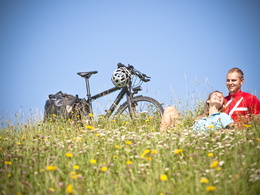
The lake district cycle tour approx. 130 km!
18 towns, length 130 km The Lakeland Tour connects all 18 towns in the Salzburg Lakeland region on a continuous cycle route. Most of the route leads along existing cycle paths through the magical landscape of the Salzburg Lake District and offers fantastic views of the lakes. Along the route you will find excellent local gastronomy as well as special scenic features, natural monuments, excursion destinations and much more. The lake district circuit can of course also be completed in stages or sections.
18 towns, length 130 km The Lakeland Tour connects all 18 towns in the Salzburg Lakeland region on a continuous cycle route. Most of the route leads along existing cycle paths through the magical landscape of the Salzburg Lake District and offers fantastic views of the lakes. Along the route you will find excellent local gastronomy as well as special scenic features, natural monuments, excursion destinations and much more. The lake district circuit can of course also be completed in stages or sections.
Most economical season
- Spring
- Summer
- Autumn
Please get in touch for more information.
Stadtplatz 2
5280 Braunau am Inn
Phone +43 7722 62644
E-Mail info@entdeckerviertel.at
Web www.entdeckerviertel.at
Web www.perwang.at
http://www.entdeckerviertel.at
http://www.perwang.at
http://www.perwang.at
Interactive elevation profile
Create PDF
Tour-Details
Starting place: 5166 Perwang am Grabensee
Destination: 5166 Perwang am Grabensee
duration: 8h 53m
length: 122,5 km
Altitude difference (uphill): 1.235m
Altitude difference (downhill): 1.234m
Lowest point: 396m
Highest point: 683m
difficulty: medium
condition: medium
panoramic view: Some Views
Paths covering:
Asphalt, Gravel, Street, Other
powered by TOURDATA