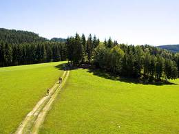
Gaspoltshofener Panoramaweg
Starting place: 4674 Gaspoltshofen
Destination: 4674 Gaspoltshofen
Hiking in Altenhof - Hausruckwald - Ödberg
Head uphill towards Farthof past the school and cemetery into the Hausruckwald forest. There you will find the signposts and can hike as you please in the shady forest on well-surfaced paths and roads. The trail also leads to the foot of the Ödberg - the summit cross is well signposted!
Parking
- Parking space: 20
- Parking area for disabled: 2
- Bus parking space: 1
- Suitable for groups
- Suitable for schools
- Suitable for kids (all ages)
- Suitable for seniors
- Suitable for single travelers
- Suitable for families
- Suitable for friends
- Suitable for couples
- Spring
- Autumn
Somewhat suitable for wheelchairs: Assistance is sometimes necessary. The measurements do not (fully) conform to the legally stipulated ÖNORM.
other information
- Toilet facility for disabled people
Altenhof
4673 Gaspoltshofen
Phone +43 7735 6954
Fax machine +43 7735 6954 - 33
E-Mail gemeinde@gaspoltshofen.ooe.gv.at
Web www.gaspoltshofen.at
http://www.gaspoltshofen.at


