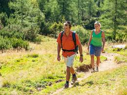
Wanderweg Weinberg Runde


Interactive elevation profile
Create PDF
Tour-Details
Starting place: 4707 Schlüßlberg
Destination: 4707 Schlüßlberg
duration: 1h 31m
length: 5,5 km
Altitude difference (uphill): 98m
Altitude difference (downhill): 98m
Lowest point: 320m
Highest point: 399m
difficulty: easy
condition: easy
panoramic view: Some Views
Paths covering:
Asphalt, Street, Hiking trail
powered by TOURDATA
Starting in the town centre towards Au to Alte Rosenau through the subway to Weinberg then down the valley towards Straßfeld and from there back to the town centre.
Most economical season
- Spring
- Summer
- Autumn
Please get in touch for more information.
4707 Schlüßlberg
Phone +43 7248 66066
Fax machine +43 7248 66066 - 20
E-Mail gemeinde@schluesslberg.ooe.gv.at
Web www.schluesslberg.ooe.gv.at
http://www.schluesslberg.ooe.gv.at
Interactive elevation profile
Create PDF
Tour-Details
Starting place: 4707 Schlüßlberg
Destination: 4707 Schlüßlberg
duration: 1h 31m
length: 5,5 km
Altitude difference (uphill): 98m
Altitude difference (downhill): 98m
Lowest point: 320m
Highest point: 399m
difficulty: easy
condition: easy
panoramic view: Some Views
Paths covering:
Asphalt, Street, Hiking trail
powered by TOURDATA