

Osternberg/Scheuhub Runde


- All weather
- Flatly
- Possible accommodation
Interactive elevation profile
Create PDF
Tour-Details
Path number: B5
Starting place: 5282 Braunau am Inn
Destination: 5282 Braunau am Inn
duration: 1h 33m
length: 6,5 km
Altitude difference (uphill): 9m
Altitude difference (downhill): 8m
Lowest point: 339m
Highest point: 353m
difficulty: easy
condition: easy
panoramic view: Some Views
Paths covering:
Asphalt, Gravel
powered by TOURDATA
OPTIK ALTBAUER RUNDE, route 5 - easy Marking: greenLength: 6.43 km Total ascent: 15 hm
Starts on the Inn cycle path at the Ranshofen barrage power station along the dam to Scheuhub. Through fields and meadows with a fantastic view of the Ranshofen castle church, then continue along the Anknach towards Osternberg. At km 3.23 you have the option of shortening the route (4.12 km in total). Medium-length, easy loop on different surfaces through the marvellous Inn landscape.
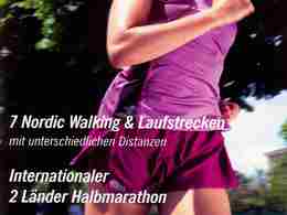
Choose from 8 different Nordic walking and running routes, which are between 2.5 km and approx. 10 km long and can be combined as you wish. This means that even ambitious runners can enjoy themselves to the full. Nothing stands in the way of your "cross-border" running either, as one of the routes is located in Simbach in Bavaria. The good signposting allows you to join the route from any point. Of course, detailed folders including elevation profiles are also available free of charge at the Braunau tourist information centre, the Simbach town office and in Braunau accommodation.
Starts on the Inn cycle path at the Ranshofen barrage power station along the dam to Scheuhub. Through fields and meadows with a fantastic view of the Ranshofen castle church, then continue along the Anknach towards Osternberg. At km 3.23 you have the option of shortening the route (4.12 km in total). Medium-length, easy loop on different surfaces through the marvellous Inn landscape.
Choose from 8 different Nordic walking and running routes, which are between 2.5 km and approx. 10 km long and can be combined as you wish. This means that even ambitious runners can enjoy themselves to the full. Nothing stands in the way of your "cross-border" running either, as one of the routes is located in Simbach in Bavaria. The good signposting allows you to join the route from any point. Of course, detailed folders including elevation profiles are also available free of charge at the Braunau tourist information centre, the Simbach town office and in Braunau accommodation.
- All weather
- Spring
- Summer
- Autumn
Please get in touch for more information.

5280 Braunau am Inn
Phone +43 7722 62644 - 0
E-Mail info@entdeckerviertel.at
Web www.entdeckerviertel.at
http://www.entdeckerviertel.at
Interactive elevation profile
Create PDF
Tour-Details
Path number: B5
Starting place: 5282 Braunau am Inn
Destination: 5282 Braunau am Inn
duration: 1h 33m
length: 6,5 km
Altitude difference (uphill): 9m
Altitude difference (downhill): 8m
Lowest point: 339m
Highest point: 353m
difficulty: easy
condition: easy
panoramic view: Some Views
Paths covering:
Asphalt, Gravel
powered by TOURDATA