

Lauf & Walking Park Friedburg-Lengau RUNDE L3


Interactive elevation profile
Create PDF
Tour-Details
Starting place: 5211 Lengau
Destination: 5211 Lengau
duration: 0h 30m
length: 3,0 km
Altitude difference (uphill): 90m
difficulty: easy
Paths covering:
Asphalt
powered by TOURDATA
Choose from 8 different Nordic walking and running routes, and there are also connecting routes to the Schneegattern Running & Walking Park with 3 routes, approx. 24 km. The connecting routes V1 & V2 link the route boards from Friedburg - Schneegattern - Naturfreundehaus. These routes are marked but not signposted.
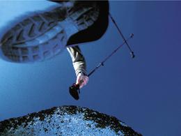
L3 XBIONIC RUNDE - easyMarking: purpleLength: 3.0 km Total ascent: 90 mThe purple X-Bionic round is ideal if you are short on time and for a short morning run. With a slight ascent on a natural surface, partly through woodland, the route leads to the Heimkehrerkapelle chapel, from there to Flörplain and gently downhill back to the starting point.
L3 XBIONIC RUNDE - easyMarking: purpleLength: 3.0 km Total ascent: 90 mThe purple X-Bionic round is ideal if you are short on time and for a short morning run. With a slight ascent on a natural surface, partly through woodland, the route leads to the Heimkehrerkapelle chapel, from there to Flörplain and gently downhill back to the starting point.
Most economical season
- Spring
- Summer
- Autumn
- Early winter
Please get in touch for more information.
Phone +43 7746 2202
E-Mail gemeinde@lengau.ooe.gv.at
Web www.gemeindelengau.at
http://www.gemeindelengau.at
Interactive elevation profile
Create PDF
Tour-Details
Starting place: 5211 Lengau
Destination: 5211 Lengau
duration: 0h 30m
length: 3,0 km
Altitude difference (uphill): 90m
difficulty: easy
Paths covering:
Asphalt
powered by TOURDATA