

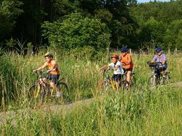
Kinder-Radtour „zum Jagdhaus“


Interactive elevation profile
Create PDF
Tour-Details
Starting place: 5131 Franking
Destination: 5131 Franking
duration: 0h 39m
length: 9,5 km
Altitude difference (uphill): 55m
Altitude difference (downhill): 56m
Lowest point: 445m
Highest point: 490m
difficulty: easy
condition: easy
panoramic view: No view
Paths covering:
Asphalt
powered by TOURDATA
Route length: approx. 9.5 km.
From Holzöster in an easterly direction, we cycle past the edge of the forest to Pimbach. The tour leads us with slight inclines via Brunn to Werberg. From there we cycle back almost to the main road and finally back to Werberg. We return to Holzöster through the forest via Oberfranking.
From Holzöster in an easterly direction, we cycle past the edge of the forest to Pimbach. The tour leads us with slight inclines via Brunn to Werberg. From there we cycle back almost to the main road and finally back to Werberg. We return to Holzöster through the forest via Oberfranking.
Most economical season
- Spring
- Summer
- Autumn
Please get in touch for more information.
Stadtplatz 2
5280 Braunau am Inn
mobile +43 7722 62644
E-Mail info@entdeckerviertel.at
Web www.entdekcerviertel.at
http://www.entdekcerviertel.at
Interactive elevation profile
Create PDF
Tour-Details
Starting place: 5131 Franking
Destination: 5131 Franking
duration: 0h 39m
length: 9,5 km
Altitude difference (uphill): 55m
Altitude difference (downhill): 56m
Lowest point: 445m
Highest point: 490m
difficulty: easy
condition: easy
panoramic view: No view
Paths covering:
Asphalt
powered by TOURDATA