Seeweg

 Interactive elevation profile

Download GPS data
Create PDF

Tour-Details

Starting place: 5221 Lochen
Destination: 5221 Lochen

duration: 3h 47m
length: 14,1 km
Altitude difference (uphill): 186m
Altitude difference (downhill): 189m

Lowest point: 514m
Highest point: 607m
difficulty: easy
condition: easy
panoramic view: Some Views

Paths covering:
Asphalt, Street, Hiking trail, Other

powered by TOURDATA

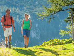
The lake trail leads from Lochen via Feldbach, Sprinzenberg, Petersham and Reitsham through beautiful farming villages to the south-east shore of Mattsee. Before the village of Sprinzenberg, you will find the Roidermarterl on the edge of the path. This trail also leads via Gebertsham (Gebertsham filial church with a magnificent viewpoint over the Salzburg Lake District) and Wichenham to Rackersing. The way back is via Hiltenwiesen, Daxjuden, Astätt and Lochen.
Travelling by public transport
Route planner for independent travellers
Most economical season
  • Spring
  • Summer
  • Autumn

Please get in touch for more information.


Seeweg
Tourismusverband Entdeckerviertel
5280 Braunau am Inn

Phone +43 7722 62644
E-Mail gemeinde@lochen.ooe.gv.at
Web www.entdeckerviertel.at
Web www.lochen.at
http://www.entdeckerviertel.at
http://www.lochen.at

We speak the following languages

German

 Interactive elevation profile

Download GPS data
Create PDF

Tour-Details

Starting place: 5221 Lochen
Destination: 5221 Lochen

duration: 3h 47m
length: 14,1 km
Altitude difference (uphill): 186m
Altitude difference (downhill): 189m

Lowest point: 514m
Highest point: 607m
difficulty: easy
condition: easy
panoramic view: Some Views

Paths covering:
Asphalt, Street, Hiking trail, Other

powered by TOURDATA