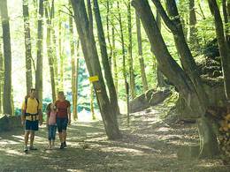
Rundweg Übers Oberholz nach Dietrichshofen


- Flatly
Interactive elevation profile
Create PDF
Tour-Details
Starting place: 4774 St. Marienkirchen bei Schärding
Destination: 4774 St. Marienkirchen bei Schärding
duration: 2h 10m
length: 8,4 km
Altitude difference (uphill): 68m
Altitude difference (downhill): 72m
Lowest point: 319m
Highest point: 393m
difficulty: medium
condition: medium
panoramic view: Individual Views
Paths covering:
Asphalt, Gravel, Street, Hiking trail
powered by TOURDATA
Walking time: 2 1/2 hours
On the Wiesenharterstraße (goods road) to Großwiesenhart, turn left at the goods road junction at the farm below, after a short distance turn right at the next junction, past the Pucher joinery or leave the goods road immediately after the bridge and continue straight ahead past the houses over the Oberholz to Hub. Once you reach the goods road, turn right past the Hub chapel and continue straight on via Lindenedt to Dietrichshofen. Turn right after the railway subway, turn right again at the next crossroads at the farms in Dietrichshofen and continue via Holzleithen to the main road, then turn right along this road back to the starting point
On the Wiesenharterstraße (goods road) to Großwiesenhart, turn left at the goods road junction at the farm below, after a short distance turn right at the next junction, past the Pucher joinery or leave the goods road immediately after the bridge and continue straight ahead past the houses over the Oberholz to Hub. Once you reach the goods road, turn right past the Hub chapel and continue straight on via Lindenedt to Dietrichshofen. Turn right after the railway subway, turn right again at the next crossroads at the farms in Dietrichshofen and continue via Holzleithen to the main road, then turn right along this road back to the starting point
Parking
- Parking space: 10
- Parking area for disabled: 1
Most economical season
- Spring
- Summer
- Autumn
Please get in touch for more information.
other information
- Toilet facility for disabled people
4774 St. Marienkirchen bei Schärding
Phone +43 7711 2254 - 0
Fax machine +43 7711 2254 - 30
E-Mail gemeinde@st-marienkirchen.ooe.gv.at
Web www.st-marienkirchen.at
http://www.st-marienkirchen.at
Interactive elevation profile
Create PDF
Tour-Details
Starting place: 4774 St. Marienkirchen bei Schärding
Destination: 4774 St. Marienkirchen bei Schärding
duration: 2h 10m
length: 8,4 km
Altitude difference (uphill): 68m
Altitude difference (downhill): 72m
Lowest point: 319m
Highest point: 393m
difficulty: medium
condition: medium
panoramic view: Individual Views
Paths covering:
Asphalt, Gravel, Street, Hiking trail
powered by TOURDATA
