

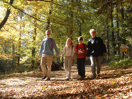
Forstweg Fraham - Rundwanderweg 3


- Suitable for families
Interactive elevation profile
Create PDF
Tour-Details
Starting place: 5273 Roßbach
Destination: 5273 Roßbach
duration: 1h 7m
length: 3,9 km
Altitude difference (uphill): 87m
Altitude difference (downhill): 88m
Lowest point: 416m
Highest point: 483m
difficulty: medium
condition: medium
panoramic view: Individual Views
Paths covering:
Asphalt, Hiking trail
powered by TOURDATA
Starting point: Roßbach town square - along the Diepoltsham municipal road to the "Heimkehrer" chapel (Marienkapelle) - via the Fraham forest road and the Puttinger estate road to Bruckwies - after crossing the state road turn right to Jaiding - past the local history museum with the Gottfried Health Symposium as well as the natural jewel "Maurerseglerkolonie in Jaiding" - to the Dannerhead municipal road - a short distance on the Via Nova trail - then left through the forest and over the Moserberg back to the starting point
- Suitable for groups
- Suitable for teenagers
- Suitable for single travelers
- Suitable for friends
- Suitable for couples
- Suitable for children
- Spring
- Summer
- Autumn
- Early winter
Please get in touch for more information.
5273 Roßbach
Phone +43 7724 8110
Fax machine +43 7724 8110 - 14
E-Mail gemeinde@rossbach.ooe.gv.at
Web www.rossbach.at
http://www.rossbach.at
You can also visit us on
Visit us on FacebookInteractive elevation profile
Create PDF
Tour-Details
Starting place: 5273 Roßbach
Destination: 5273 Roßbach
duration: 1h 7m
length: 3,9 km
Altitude difference (uphill): 87m
Altitude difference (downhill): 88m
Lowest point: 416m
Highest point: 483m
difficulty: medium
condition: medium
panoramic view: Individual Views
Paths covering:
Asphalt, Hiking trail
powered by TOURDATA