

Hofinger Kapelle - Rundwanderweg 4
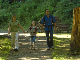


- Suitable for families
Interactive elevation profile
Create PDF
Tour-Details
Starting place: 5273 Roßbach
Destination: 5273 Roßbach
duration: 2h 3m
length: 7,2 km
Altitude difference (uphill): 147m
Altitude difference (downhill): 153m
Lowest point: 402m
Highest point: 493m
difficulty: medium
condition: medium
panoramic view: Individual Views
Paths covering:
Asphalt, Gravel, Hiking trail
powered by TOURDATA
Route:
town square Roßbach - on the sidewalk along the Aspacher road to Buch - over the road Schiefeck along the Via Nova path - turn right towards Hofinger chapel - "Naturjuwelweg" path - continue towards Gschaidt - past the Tümpel cottage Gschaidt (awarded as a nature jewel) - via Wesen (Uberl) up to Edt and further to the nature jewel "Moortümpel Eisbahn" - across the Edter road and past the nature garden in Edt (Scheirl - awarded as nature jewel) to the Roßbacher road - past the Horner Chapel and back to the starting point
town square Roßbach - on the sidewalk along the Aspacher road to Buch - over the road Schiefeck along the Via Nova path - turn right towards Hofinger chapel - "Naturjuwelweg" path - continue towards Gschaidt - past the Tümpel cottage Gschaidt (awarded as a nature jewel) - via Wesen (Uberl) up to Edt and further to the nature jewel "Moortümpel Eisbahn" - across the Edter road and past the nature garden in Edt (Scheirl - awarded as nature jewel) to the Roßbacher road - past the Horner Chapel and back to the starting point
- Suitable for groups
- Suitable for friends
- Suitable for couples
- Spring
- Summer
- Autumn
- Early winter
Please get in touch for more information.
5273 Roßbach
Phone +43 7724 8110
Fax machine +43 7724 8110 - 14
E-Mail gemeinde@rossbach.ooe.gv.at
Web www.rossbach.at
http://www.rossbach.at
Interactive elevation profile
Create PDF
Tour-Details
Starting place: 5273 Roßbach
Destination: 5273 Roßbach
duration: 2h 3m
length: 7,2 km
Altitude difference (uphill): 147m
Altitude difference (downhill): 153m
Lowest point: 402m
Highest point: 493m
difficulty: medium
condition: medium
panoramic view: Individual Views
Paths covering:
Asphalt, Gravel, Hiking trail
powered by TOURDATA