

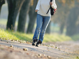
Route 19 Kneippbeckenwanderung


- Suitable for families
- Suitable for kids (all ages)
Interactive elevation profile
Create PDF
Tour-Details
Starting place: 5273 St. Veit im Innkreis
Destination: 5273 St. Veit im Innkreis
duration: 0h 31m
length: 2,1 km
Altitude difference (uphill): 14m
Altitude difference (downhill): 11m
Lowest point: 399m
Highest point: 420m
difficulty: medium
condition: medium
panoramic view: Individual Views
Paths covering:
Hiking trail
powered by TOURDATA
Route:
from the community center on the Kneipp hiking trail to the St. Veiter brook further to the hedge teaching path - from there back to the community center
from the community center on the Kneipp hiking trail to the St. Veiter brook further to the hedge teaching path - from there back to the community center
- Suitable for groups
- Suitable for kids (all ages)
- Suitable for seniors
- Suitable for friends
- Suitable for couples
- Spring
- Summer
- Autumn
- Early winter
Please get in touch for more information.
5273 St. Veit im Innkreis
Phone +43 7723 6113
Fax machine +43 7723 6113 - 4
E-Mail gemeinde@st-veit-innkreis.ooe.gv.at
Web www.st-veit-innkreis.at
http://www.st-veit-innkreis.at
Interactive elevation profile
Create PDF
Tour-Details
Starting place: 5273 St. Veit im Innkreis
Destination: 5273 St. Veit im Innkreis
duration: 0h 31m
length: 2,1 km
Altitude difference (uphill): 14m
Altitude difference (downhill): 11m
Lowest point: 399m
Highest point: 420m
difficulty: medium
condition: medium
panoramic view: Individual Views
Paths covering:
Hiking trail
powered by TOURDATA