© Foto: Oberösterreich Tourismus GmbH/Robert Maybach: Gesellige Runde am Wolfgangsee
Gruppe junger Menschen auf einem Steg am Wolfgangsee

Zur Burgsteinmauer

  • Suitable for families

 Interactive elevation profile

Download GPS data
Create PDF

Tour-Details

Starting place: 4391 Waldhausen im Strudengau
Destination: 4391 Waldhausen im Strudengau

duration: 3h 12m
length: 8,3 km
Altitude difference (uphill): 615m
Altitude difference (downhill): 131m

Lowest point: 458m
Highest point: 944m
difficulty: medium
condition: medium
panoramic view: Individual Views

Paths covering:
Asphalt, Hiking trail

powered by TOURDATA

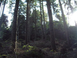
At the Bursteinmauer vantage point, you can enjoy a marvellous view of the Mühlviertel and Waldviertel. From the market to the "Grabner in the corner" is identical with the outlook Waldhausener round, the "Grabner in the corner" over the ridge into the valley of the Little Ysper. At the "Heftner-houses" over and along the road a piece. Then turn left to "Hößberger" and on to the castle stone wall (973 m) - magnificent panoramic view.
Travelling by public transport
Route planner for independent travellers
General price information

free entrance

  • Suitable for groups
  • Suitable for schools
Most economical season
  • Spring
  • Summer
  • Autumn

Please get in touch for more information.


Zur Burgsteinmauer
Tourismusverein Waldhausen
Markt 14
4391 Waldhausen im Strudengau

Phone +43 7260 4505
E-Mail tourismus@waldhausen.ooe.gv.at
Web www.tourismus-waldhausen.com
http://www.tourismus-waldhausen.com

We speak the following languages

German

 Interactive elevation profile

Download GPS data
Create PDF

Tour-Details

Starting place: 4391 Waldhausen im Strudengau
Destination: 4391 Waldhausen im Strudengau

duration: 3h 12m
length: 8,3 km
Altitude difference (uphill): 615m
Altitude difference (downhill): 131m

Lowest point: 458m
Highest point: 944m
difficulty: medium
condition: medium
panoramic view: Individual Views

Paths covering:
Asphalt, Hiking trail

powered by TOURDATA