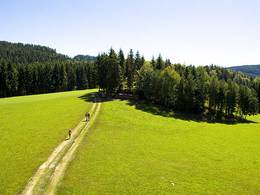
Pendellehrpfad - Luxberg
Guided tours are possible - phone Christian Weinbörmayr for an appointment
Follow the path with the number K 30.Information boards with detailed descriptions allow you to follow the nature trail on your own. If you want to learn how to use a "divining rod", there are special expert guided tours.
Then it's uphill - to the Karning candle studio. It's not just the beautiful view that makes up for it, but also the creative variety of candles that you will find in this studio.
Via the K 34 you come to the "Gasthaus zur Sonne". A refreshment before the return march to Kefermarkt via the rest of the K 34 and K 31 can't hurt. Once you arrive in Kefermarkt, the businesses are looking forward to your visit!
Paths covering:
further information:
- Flatly
Details - hiking
- educational path
by car:
Take the A7 Mühlkreis motorway from Linz towards Freistadt or Prague; at the end of the motorway in Unterweitersdorf, turn left onto the B310 towards Freistadt/Prague and after about 10 km turn right to Kefermarkt. (Linz-Kefermarkt = 33km)
By train:
Linz main station to Kefermarkt = 43 km. (Linz - Summerau - Prague railway line)
- Suitable for seniors
- Suitable for single travelers
- Suitable for families
- Suitable for couples
- Spring
- Summer
- Autumn
Please get in touch for more information.
Oberer Markt 15
4292 Kefermarkt
Phone +43 7947 5910
E-Mail gemeinde@kefermarkt.ooe.gv.at
Web www.kefermarkt.ooe.gv.at
Web www.muehlviertel-urlaub.at/wandern
http://www.muehlviertel-urlaub.at/wandern


