

Luag amoi - Weg


- pets allowed
- culturally interesting
- Flatly
Interactive elevation profile
Create PDF
Tour-Details
Path number: Hi3
Starting place: 4242 Hirschbach im Mühlkreis
Destination: 4242 Hirschbach im Mühlkreis
duration: 1h 40m
length: 5,1 km
Altitude difference (uphill): 205m
Altitude difference (downhill): 181m
Lowest point: 633m
Highest point: 792m
difficulty: easy
condition: easy
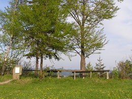
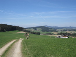
panoramic view: Great panorama
Paths covering:
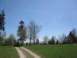
Hiking trail
powered by TOURDATA
Easy, leisurely hike, also suitable as a walking route! A short stretch on the road towards Schenkenfelden, then right towards Kirchberg, past the Brandstetterhof with a view of Hirschbach!
A short stretch along the Nordwaldkammweg, with views of the airfield and the Sternstein (1122 m)! Continue via Vierhöfer to the Luag viewing point (781 m). On a clear day you can see as far as the Ötscher (1893 m) and Schneeberg (2076 m) in Lower Austria and the eastern Mühlviertel!
Continue via Kirchberg, back to Hirschbach-Ort.
further information:
- Flatly
Details - hiking
- themed path
Parking
- Parking space: 20
- Bus parking space: 1
- Suitable for groups
- Suitable for schools
- Pets allowed
- Spring
- Summer
- Autumn
Please get in touch for more information.

Museumsweg 6
4242 Hirschbach im Mühlkreis
Phone +43 7948 55895
E-Mail info@kraeuterkraftquelle.at
Web www.kraeuterkraftquelle.at
http://www.kraeuterkraftquelle.at
Interactive elevation profile
Create PDF
Tour-Details
Path number: Hi3
Starting place: 4242 Hirschbach im Mühlkreis
Destination: 4242 Hirschbach im Mühlkreis
duration: 1h 40m
length: 5,1 km
Altitude difference (uphill): 205m
Altitude difference (downhill): 181m
Lowest point: 633m
Highest point: 792m
difficulty: easy
condition: easy
panoramic view: Great panorama
Paths covering:
Hiking trail
powered by TOURDATA