

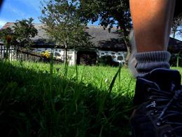
Erholungsweg Nr. 6


- Flatly
- Possible accommodation
Interactive elevation profile
Create PDF
Tour-Details
Starting place: 4280 Königswiesen
Destination: 4280 Königswiesen
duration: 1h 3m
length: 3,4 km
Altitude difference (uphill): 111m
Altitude difference (downhill): 114m
Lowest point: 571m
Highest point: 648m
difficulty: easy
condition: easy
panoramic view: Great panorama
Paths covering:
Hiking trail
powered by TOURDATA
Königswiesen - north-east direction - Leitner - villa of the hammer lords from Remscheid - Schwarzmühle, along the Schwarzaubach - E-Werk - before Grabenhammer turnoff Königswiesen - Mühlehen - Königswiesen
Most economical season
- Summer
Please get in touch for more information.
4280 Königswiesen
Phone +43 7955 6255
Fax machine +43 7955 6255 - 32
E-Mail marktgemeinde@koenigswiesen.at
Web www.koenigswiesen.at
http://www.koenigswiesen.at
Interactive elevation profile
Create PDF
Tour-Details
Starting place: 4280 Königswiesen
Destination: 4280 Königswiesen
duration: 1h 3m
length: 3,4 km
Altitude difference (uphill): 111m
Altitude difference (downhill): 114m
Lowest point: 571m
Highest point: 648m
difficulty: easy
condition: easy
panoramic view: Great panorama
Paths covering:
Hiking trail
powered by TOURDATA