

Winterwanderweg - große Runde


- Flatly
Interactive elevation profile
Create PDF
Tour-Details
Starting place: 4280 Königswiesen
Destination: 4280 Königswiesen
duration: 1h 15m
length: 4,8 km
Altitude difference (uphill): 120m
Altitude difference (downhill): 120m
Lowest point: 564m
Highest point: 680m
difficulty: medium
condition: difficult
panoramic view: Great panorama
Paths covering:
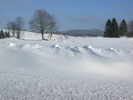
snow
powered by TOURDATA
The route runs from the shore along the Greinerstraße to the Wirtschaftsimpulszentrum and from there along the old path to Schlag to the Riener Kreuz. From Riener Kreuz, the route continues to Schützenhof and then to Mayrhofweg. From the crossroads, the route goes via Mayrhof to "Reiterhof Herberger" and from there to Waldstraße. From there, you return to the starting point in Ufer via Bergstraße and the B124.
This winter hiking trail is also suitable for runners and walkers.
Please pay attention to the blue signs!!!
This winter hiking trail is also suitable for runners and walkers.
Please pay attention to the blue signs!!!
further information:
- Flatly
Details - hiking
- cleared winter hiking path
Most economical season
- Early winter
- Deep winter
Please get in touch for more information.
4280 Königswiesen
Phone +43 7955 6255
Fax machine +43 7955 6255 - 32
E-Mail marktgemeinde@koenigswiesen.at
Web www.koenigswiesen.at
http://www.koenigswiesen.at
Interactive elevation profile
Create PDF
Tour-Details
Starting place: 4280 Königswiesen
Destination: 4280 Königswiesen
duration: 1h 15m
length: 4,8 km
Altitude difference (uphill): 120m
Altitude difference (downhill): 120m
Lowest point: 564m
Highest point: 680m
difficulty: medium
condition: difficult
panoramic view: Great panorama
Paths covering:
snow
powered by TOURDATA