Radrunde Viehberg-Maltsch Nr. 906

  • Flatly

 Interactive elevation profile

Download GPS data
Create PDF

Tour-Details

Path number: 906
Starting place: 4263 Windhaag bei Freistadt
Destination: 4263 Windhaag bei Freistadt

duration: 1h 56m
length: 23,4 km
Altitude difference (uphill): 475m
Altitude difference (downhill): 471m

Lowest point: 686m
Highest point: 1.006m
difficulty: easy
condition: medium
panoramic view: Individual Views

Paths covering:
Asphalt

powered by TOURDATA

Border experiences on the Museum Route Character: hilly cycle tour on tarmac cycle paths and quiet side roads.

Difference in altitude: cycle tour approx. 500 m, forest nature trail 100 m.

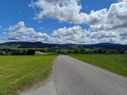
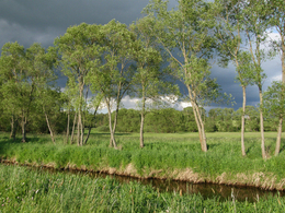
You should take a little extra time for this wonderful cycle tour - not only to enjoy the beautiful landscape in the mysterious Freiwald forest on the border to the Waldviertel and Bohemia, but also to visit six museums and a very special sacred sight on the "Mühlviertel Museum Route".

To be precise, there are also the historical railway relics near Kerschbaum, where the Linz - Budweis horse-drawn railway crossed the watershed between the Danube and the Vltava. From the railway station, we cycle briefly alongside the tracks to the northern edge of Summerau, turn right there and head north over the level crossing. Climbing in places, we reach Zulissen, where we turn right.

We now follow the signs for the Grenzland cycle path and reach Deutsch Hörschlag on the other side of the railway line. Turn right here towards Rainbach. At Heiligenberg, the road to Kerschbaum branches off sharply to the left - there, of course, we visit the renovated horse-drawn railway station, which is located a little to the right off the Grenzland cycle path. This turns left and then immediately right again to reach the border settlement of Wullowitz via Edlbruck and Eisenhut on mountainous goods and field tracks.
border settlement of Wullowitz.

There we cross the main road and ride into the village of Stiegersdorf, which lies on the Maltsch and thus directly on the Czech border. Turn right here and head into the valley to Leopoldschlag Markt. Continue along the lively Maltsch - past old quarries and the old Zettwing church on the Bohemian side - to Mairspindt.

Here we turn off to the right and head into the pretty "museum village" of Windhaag, where you can visit the Mühlviertler Waldhaus, the open-air museum Handwerkshaus Stegwagner, the Felbermühle Venetian sawmill and the Hofwieshammer open-air museum; short detours lead to the Untere Leithenmühle on the Hängerbach in Rimetschlag and to the Lackinger carpenter's house in Pieberschlag, where there is also a "granite garden" and an interesting forest nature trail.

It's best to stay here for a day or two and immerse yourself in the old world of craftsmanship. Then you will have fuelled up for the second part of the tour: back to Mairspindt, now turn right and cycle up the Grenzland cycle path over the Maltsch valley towards Sandl. A particularly romantic section of the route begins at the single-layered farms of Unterwald, which leads through almost impenetrable forest - partly on tarmac, partly on the gravel track.

The darkness only lifts again in Hacklbrunn: we cycle up to the village of Sandl at an altitude of 927 metres. There we turn right towards Freistadt. We now have to make do with the busy main road for approx. 8 km - at least it's mostly flat or downhill.
mostly flat or downhill. In Oberrauchenödt, we turn right and pedal up to the late Gothic church of St Michael. It is one of the oldest churches in the Mühlviertel and has a beautiful Gothic winged altar. After Mitterbach, we cycle back down into the valley.

From there, turn left towards Heinrichschlag and Grünbach. Turn right towards Windhaag, but shortly afterwards turn left towards Lichtenau and Rainbach. In this pretty village we cross the Linz - Budweis main road again, cycle down into the Rainbach valley and then up to Summerau on the other side.

Route: Summerau - Windhaag 24 km, to Sandl 12 km, back to Summerau 26 km.

Hike: Forest nature trail near Windhaag 1-2 h (cycle access to Pieberschlag approx. 2 km).

Refreshments: inns in all larger towns along the way.

Route: Summerau - Windhaag 24 km, to Sandl 12 km - Summerau 26 km

 Interactive elevation profile

Download GPS data
Create PDF

Tour-Details

Path number: 906
Starting place: 4263 Windhaag bei Freistadt
Destination: 4263 Windhaag bei Freistadt

duration: 1h 56m
length: 23,4 km
Altitude difference (uphill): 475m
Altitude difference (downhill): 471m

Lowest point: 686m
Highest point: 1.006m
difficulty: easy
condition: medium
panoramic view: Individual Views

Paths covering:
Asphalt

powered by TOURDATA