Schiederweiher - Polsterstüberl - Dietlgut
Path number: 201,209
Starting place: 4573 Hinterstoder
Destination: 4573 Hinterstoder
Hinterstoder 38
4573 Hinterstoder
4573 Hinterstoder

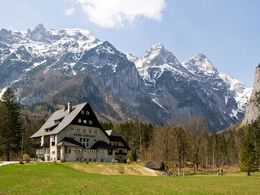
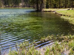
Hike to picturesque Schiederweiher lake and the Polsterstüberl, then continue to Dietlkapelle chapel and the Dietlgut.
Continue your hike as far as the Polsterstüberl, where you will branch off briefly to the left, making your way on path No. 209, along the edge of meadows, then through a forest until you reach a crossing by a bridge.
If you take the paved road to the left, you will come to the Polsterluckenwirt (2 minutes on path No. 12).
Take a right at the crossroads, and walk via path No. 209 alongside fences to the Nickergut. This path takes you through the farm, then past some houses and meadows. Shortly before you reach the Dietlgut, the Dietlkapelle is on your right. This beautiful forest chapel invites you to enjoy a reflective break. After a few more minutes, you will reach the Dietlgut.
Hiking paths Nos.: 201, 209
Path number: 201,209
Starting place: 4573 Hinterstoder
Destination: 4573 Hinterstoder
duration: 1h 58m
length: 6,1 km
Altitude difference (uphill): 243m
Altitude difference (downhill): 192m
Lowest point: 609m
Highest point: 728m
difficulty: very easy
condition: easy
panoramic view: Great panorama
Paths covering:
Gravel, Hiking trail
Starting point: Schiederweiher car park in Hinterstoder
Destination: Hotel Dietlgut Hinterstoder
further information:
- Board possible
Details - hiking
- cleared winter hiking path
Accessibility / arrival
The starting point is the parking lot Schiederweiher (paying) - about 1.5 km to the center Hinterstoder.
Parking- Parking space: 150
up to 6 hours 6.00 euros | up to 24 hours 9.00 euros 7-day parking ticket 18.00 euros | annual parking ticket 35.00 euros | The annual parking ticket entitles you to park up to two vehicle licence plates and is available at the Hinterstoder municipal office.
- Suitable for pushchairs
- Spring
- Summer
- Autumn
- Early winter
- Deep winter
Please get in touch for more information.
Hinterstoder 38
4573 Hinterstoder
Phone +43 7564 5263
E-Mail hinterstoder@pyhrn-priel.net
Web www.urlaubsregion-pyhrn-priel.at/
https://www.urlaubsregion-pyhrn-priel.at/


