Dietlgut - Baumschlagerreith - Steyrursprung
4573 Hinterstoder

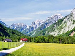
A leisurely hike through the forest and meadow landscape of Hinterstoder to the source of the river Steyr. In between there is the possibility of a stop at Baumschlagerreith.
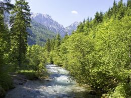
Behind the Baumschlagerreith, the hiking trail, which initially runs along a forest road, leads you in about 15 minutes to the source of the Steyr.
The Steyr rises from a total of 7 springs that seep out of the forest floor.
You return via the same path.
Alternatively, you can take the access road to Baumschlagerreith (trail 216) to the Bärenalm car park and then turn left to Dietlgut.
Hiking trail number: 209a
Paths covering:
further information:
- Board possible
Drive through the centre of Hinterstoder and follow the main road to Dietlgut.
(47.669164, 14.106021)
There is a bus stop directly at Dietlgut.
Parking is available at the Bärenalm car park (subject to charge).
(47.664457, 14.106177)
You can get on the hiking trail 209a at the car park. Distance to Dietlgut approx. 10 minutes on foot.
In Hinterstoder your parking ticket is also valid as a ticket for the valley bus.
https://www.urlaubsregion-pyhrn-priel.at/en/hinterstoder/parking-and-mobility.html
Parking & Mobility in Hinterstoder – Everything you need to know. With only a few exceptions, there is a fee for parking in Hinterstoder – your valid parking ticket also serves as a ticket for the valley bus, which regularly connects the village with Polsterlucke, Dietlgut and Baumschlagerreith. Free parking and transfer to the valley bus. Everyone who travels in using their own car can park on the lift car park at the entrance to our village. These parking areas are available to use free of charge. In hiking season, the “tälerbus.hinterstoder” (valley bus) starts from here, regularly connecting the village with hiking areas in the Polsterlucke, Dietlgut and all the way to the Baumschlagerreith. Short-term parking zone in the village centre All of the village centre is a short-term parking zone, where parking is restricted to a maximum of 90 minutes. Charged parking from the village centre into the valley. As you head into the valley from the village centre, there are three parking areas available to you, conveniently located at trail heads for our network of hiking paths as well as for “Rundwanderwelt Hinterstoder”. They also feature info points with useful hiking information. There is a fee for use of these three car parks. - “Schiederweiher” car park (by the Johannishof, access from Schiederweiher & Polsterlucke) - “Polsterlucke” car park (by Pehamvilla, access from Polsterlucke) - “Bärenalm” car park (at the end of the valley, close to the Dietlgut) Your car park ticket is also your ticket for the valley bus. With a valid parking receipt, for the driver of the car use of “tälerbus.hinterstoder” is free from the car park in question. Leaving the village centre – ride the valley bus into the valley for free Arrive by bus or take advantage of free parking on the lift car park. You can then take the valley bus for free from the Pachleitner stop in the direction of Polsterlucke as well as Baumschlagerreith. Parking charges up to 4 hours: 2.00 Euro; up to 24 hours: 3.00 Euro; 7-day parking ticket 5.00 Euro; annual parking ticket 20.00 Euro The annual parking ticket entitles you to park up to two vehicles with different plates and is available exclusively from the village hall. How do you pay the parking charges? Fees up to 5 Euro are paid at the parking ticket machines. Important: The machine does not give change! The annual parking tickets are available from the village hall. You may provide up to two different vehicle license plate numbers. Please display your parking ticket behind your windscreen and ensure it is clearly visible. What are the proceeds used for? Proceeds from parking fees are used to maintain the extensive recreational infrastructure on the one hand, and on the other to be able to offer eco-friendly mobility services. This benefits guests, locals and our nature.
- Suitable for teenagers
- Suitable for seniors
- Suitable for single travelers
- Suitable for families
- Suitable for friends
- Suitable for couples
- Suitable for children
- Spring
- Summer
- Autumn
Please get in touch for more information.
Hinterstoder 38
4573 Hinterstoder
Phone +43 7564 5263
Fax machine +43 7564 5263 - 30
E-Mail hinterstoder@pyhrn-priel.net
Web www.urlaubsregion-pyhrn-priel.at/


