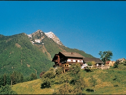
Tambergau - Sonnleiten – Circular Trail
Path number: 45
Starting place: 4573 Hinterstoder
Destination: 4573 Hinterstoder
From the former country inn Gasthaus Gausrab in Hinterstoder to the Peterhof and Hofbauer farms, then turn left up to the Hackl farm (Bruderhofer-Hütte) and further to Pension Lögergut.
From the former country inn Gasthaus Gausrab in Hinterstoder to the Peterhof and Hofbauer farms, then turn left up to the Hackl farm (Bruderhofer-Hütte) and further to Pension Lögergut. Continue to your left to the Bruderhof farm or a bit further to your right to the Immerl farm and then to the Bruderhof. (highest point of the hike with stunning circular view over the Tambergau.) Walk through the farm courtyard, turn left onto a flat dirt road and continue downhills through the forest along a gravel road leading further downhills zu the Salmer farm and on to a smal tar road to the Stoder valley country road and back to your starting point.Trail-Nr: 45
Accessibility / arrival
The starting point is the farm in the district Gausrab Tambergau.
Most economical season
- Spring
- Summer
- Autumn
Please get in touch for more information.
Hinterstoder 38
4573 Hinterstoder
Phone +43 7564 5263 - 99
Fax machine +43 7564 5263 - 30
E-Mail hinterstoder@pyhrn-priel.net
Web www.urlaubsregion-pyhrn-priel.at/
https://www.urlaubsregion-pyhrn-priel.at/


