Dolomitensteig Climb
4573 Hinterstoder

Description: The Dolomitensteig is closed every year from 15 September to 01 October for hunting reasons.
Under the spell of mighty rock formations
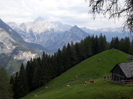
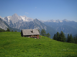
The challenging Stoderer Dolomitensteig in Hinterstoder is impressively alpine: green mountain pastures with grazing animals and views of wild and romantic gorges alternate with majestic mountain panoramas.
After the first ascent, open alpine meadows open up - a sign that the unmanaged Hochsteinalm has been reached. After decades of inactivity, cattle are once again being herded onto the pastures. A short section through a sparse larch forest leads on to the Logerhütte. Here it is worth taking a break with a view of the impressive mountain giants of the Totes Gebirge, whose rock massifs are criss-crossed by wild valleys.
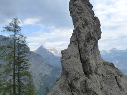
The exposed section of the Dolomitensteig then begins. The partly secured trail runs gently up and down along steep rock faces, through trenches and over hilltops. The route leads through an untamed mountain landscape of brittle dolomite rock, rugged rock towers and finely chipped scree slopes. The crystal-clear pools, whose water offers a refreshing cool-down, form a contrast to this.
The descent into the valley follows a less demanding path through larch and beech forests. A forest road forms the end of the tour and leads back to the parking lot at Almgasthof Baumschlagerreith.
Caution:- Mountain boots recommended
- Alpine trail, partly secured with steel cables.
- A head for heights, sure-footedness and mountain experience are required; children should be at least 10 years old.
For hunting reasons, the trail is closed every year from September 15 to October 1.
Paths covering:
further information:
- Flatly
- Board possible
The trail is particularly recommended on hot days, when the crystal-clear water of the Gumpenkaskaden invites you to cool off.
For hunting reasons, the trail is closed every year from September 15 to October 1!
A9 to Exit St Pankraz / Hinterstoder, turn left onto B138 towards Hinterstoder; into the river sink turn towards Hinterstoder / Stodertal, follow the main road through Hinterstoder through towards the valley, follow the signs for guest house Baumschlagerreith; asphalt road to the guest house.
Paid car park
E-service station / recharging station- Charging point for e-bikes (free of charge)
- Suitable for groups
- Suitable for teenagers
- Suitable for seniors
- Suitable for single travelers
- Suitable for friends
- Suitable for couples
- Spring
- Summer
- Autumn
Please get in touch for more information.
Hinterstoder 38
4573 Hinterstoder
Phone +43 7564 5263
Fax machine +43 7564 5263 - 30
E-Mail hinterstoder@pyhrn-priel.net
Web www.urlaubsregion-pyhrn-priel.at/
You can also visit us on
Facebook Instagram Pinterest YouTube


