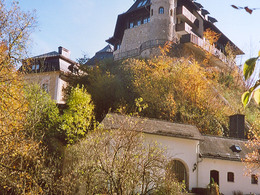
Circular Hiking Trail Schönberg
Starting place: 4564 Klaus an der Pyhrnbahn
Destination: 4564 Klaus an der Pyhrnbahn
The Circular Hiking Trail Schönberg offers beautiful views to the Spering, Warscheneck and to Klaus. Return along descending serpentines.
The hike around the Schönberg mountain begins at the Klaus railway station and leads along the rail dam to the Schedlbauerngut farm. From there the trail ascends slightly and leads into a forest road to the left just before the Hungerbichler chapel.The forest road leads from Schönberg via Gröbnerreith to the Schedlbauernalm. This hike is a bit more strenuous, but offers beautiful sights into the Steyr valley.
Trail-Nr: 5
Starting place: 4564 Klaus an der Pyhrnbahn
Destination: 4564 Klaus an der Pyhrnbahn
duration: 1h 33m
length: 4,5 km
Altitude difference (uphill): 210m
Altitude difference (downhill): 216m
Lowest point: 468m
Highest point: 664m
difficulty: very easy
condition: easy
panoramic view: Great panorama
Paths covering:
Asphalt, Gravel
Starting point: Klaus railway station
Destination: Klaus railway station
further information:
- Flatly
Accessibility / arrival
by car:
From Vienna: West motorway direction Salzburg - A1 junction Voralpenkreuz - A9 exit Klaus
From Munich: A8 Salzburg - West motorway A1 towards Linz - turn Voralpenkreuz - A9, exit Klaus
From Berlin: A9 Bayreuth - Nuremberg - A3 Regensburg - Passau - A8 to Konoten Voralpenkreuz - A9, exit Klaus
by train:
Vienna - Linz - Klaus at the Pyhrnbahn;
Munich - Salzburg - Linz - Klaus at the Pyhrnbahn;
Hamburg - Passau - Linz - Klaus at the Pyhrnbahn;
Frankfurt - Passau - Linz - Klaus at the Pyhrnbahn;
Berlin - Nürnberg - Passau - Linz - Hinterstoder;
Most economical season
- Spring
- Summer
- Autumn
Please get in touch for more information.
Kniewas 17
4564 Klaus an der Pyhrnbahn
Phone +43 7565 31333
E-Mail klaus@pyhrn-priel.net
Web www.urlaubsregion-pyhrn-priel.at
https://www.urlaubsregion-pyhrn-priel.at


