Mountain Hike to the Spering
Starting place: 4564 Klaus an der Pyhrnbahn
Destination: 4564 Klaus an der Pyhrnbahn
Bahnhofstraße 2
4580 Windischgarsten
4580 Windischgarsten

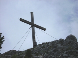
Via alpine meadows and partly steep trail you get to the summit ridge, leading along an up and down path to the summit of the Spering (1605 m).
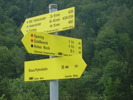
To get to the Spering, coming from the leisure centre Klausersee on trail nr. 409 turn left onto AV trail nr. 465 after the Bertlgut farm.The ascent to the Haidenalm (broken down pasture hut) is not strenuous and leads mainly through forest area. Via alpine meadows and partly steep trail you get to the summit ridge, leading along an up and down path to the summit of the Spering (1605 m). From there you can enjoy a most rewarding circular view of the mountain ranges of the Hallermauern, the Warscheneck massive and the Tote Gebirge, as well as a beautiful view down to the Klaus reservoir and the region of the Pre-Alps.
Descent options via AV - Trail Nr. 460, turning in a southerly direction above the Haidenalm pasture, leading to the Speringbauer farm and via the tavern, Gasthaus Pernkopf to the trainstation of Hinterstoder.
Hikers with endurance can continue on the way back from the Speringbauer farm via the circular hiking trail Klauser reservoir (3 hrs. – see description “Circular Hiking Trail Klauser Reservoir)
Trail-Nr: 409, 465, 460
Starting place: 4564 Klaus an der Pyhrnbahn
Destination: 4564 Klaus an der Pyhrnbahn
duration: 4h 45m
length: 6,5 km
Altitude difference (uphill): 1.166m
Altitude difference (downhill): 1.166m
Lowest point: 481m
Highest point: 1.591m
difficulty: medium
condition: medium
panoramic view: Great panorama
Paths covering:
Asphalt, Gravel, Hiking trail
Starting point: Leisure centre Klausersee
Destination: Spering
Accessibility / arrival
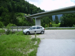
Klaus on the Pyhrnbahn; turn over the dam towards woman stone, after the dam right in the Pertlgraben along the road at a farm over, which is left to lie to the left, under the highway come through yet, just before a bridge, here you have options for parking.
Most economical season
- Spring
- Summer
- Autumn
Please get in touch for more information.
Bahnhofstraße 2
4580 Windischgarsten
Phone +43 7562 5266
E-Mail info@pyhrn-priel.net
Web www.urlaubsregion-pyhrn-priel.at
https://www.urlaubsregion-pyhrn-priel.at


