Circular Hiking Trail Klausersee - Fischersteig
4564 Klaus an der Pyhrnbahn

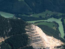
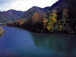
This circular hiking trail was errected during the landscape design around the Klaus reservoir during the building period of the power station.
The trail is very beautiful and versatile leading around the entire reservoir lake. Main starting points are the villages of Klaus and Kniewas.It is possible to enter the circular hiking trail of the Klaus reservoir at many other points as well. The most important ones are: Hofwiese, former Voest settlement (at the lime factory), train station Steyrling or Hinterstoder.
The trail is labeled as "Fischersteig" all the way with blue-white markings. Please beware of steep embankments every now and again and watch carefully over children.
Trail-Nr: "Fischerweg"
Walking time: 5 - 7 hrs.
Paths covering:
further information:
- Flatly
- Board possible
Details - hiking
- themed path
by car:
From Vienna: West motorway direction Salzburg - A1 junction Voralpenkreuz - A9 exit Klaus
From Munich: A8 Salzburg - West motorway A1 towards Linz - turn Voralpenkreuz - A9, exit Klaus
From Berlin: A9 Bayreuth - Nuremberg - A3 Regensburg - Passau - A8 to Konoten Voralpenkreuz - A9, exit Klaus
by train:
Vienna - Linz - Klaus at the Pyhrnbahn;
Munich - Salzburg - Linz - Klaus at the Pyhrnbahn;
Hamburg - Passau - Linz - Klaus at the Pyhrnbahn;
Frankfurt - Passau - Linz - Klaus at the Pyhrnbahn;
Berlin - Nürnberg - Passau - Linz - Hinterstoder;
- Spring
- Summer
- Autumn
Not suitable for wheelchairs. The property is not compliant with Austria's ÖNORM legal standard.
Not accessible by wheelchair
Kniewas 17
4564 Klaus an der Pyhrnbahn
Phone +43 7565 31333
E-Mail klaus@pyhrn-priel.net
Web www.urlaubsregion-pyhrn-priel.at


