Brunnental - Ring – Ödseen Lakes
Starting place: 4571 Klaus an der Pyhrnbahn
Destination: 4571 Klaus an der Pyhrnbahn
Bahnhofstraße 2
4580 Windischgarsten
4580 Windischgarsten

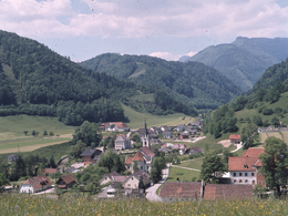
From Steyrling hike partly along the road and partly along trail nr. 404 into the Brunnental valley.
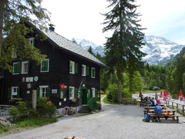
The road leads further through Bernerau into the idyllic valley end. Via a climb you get to the so-called Ring (897 m) with stunning views from the „Herrentisch" (master’s table) over the alpine landscape from the mountains Priel to Taunstein and continue down to the large and small Ödsee lakes and to the Almtalerhaus. From here trail nr. 404 takes you into the Almtal valley.Trail-Nr: 404
Walking time: about 5 hrs.
Starting place: 4571 Klaus an der Pyhrnbahn
Destination: 4571 Klaus an der Pyhrnbahn
duration: 4h 16m
length: 12,3 km
Altitude difference (uphill): 642m
Altitude difference (downhill): 446m
Lowest point: 518m
Highest point: 892m
difficulty: medium
condition: easy
panoramic view: Some Views
Paths covering:
Gravel, Hiking trail
Starting point: Steyrling
further information:
- Board possible
Accessibility / arrival
A9 motorway - exit St. Pankraz - Then turn left onto B138 - After 5 km turn left towards Steyrling
Most economical season
- Spring
- Summer
- Autumn
Please get in touch for more information.
Bahnhofstraße 2
4580 Windischgarsten
Phone +43 7562 5266
E-Mail info@pyhrn-priel.net
Web www.urlaubsregion-pyhrn-priel.at
https://www.urlaubsregion-pyhrn-priel.at


