Theme walk "Path of Millions"
Path number: 10
Starting place: 4580 Windischgarsten
Destination: 4581 Rosenau am Hengstpaß
Hauptstraße 28
4580 Windischgarsten
4580 Windischgarsten

The historic route of Proviantweg joined the Garstnertal in the big time of the "Black Count" with the Styrian Eisenwurzen over the Hengstpaß. We walk from Windischgarsten first on Millionenweg and then on Proviantweg to the pastures at Hengstpaß.
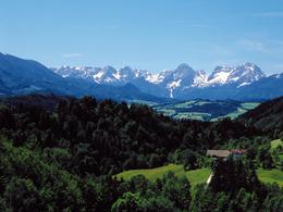
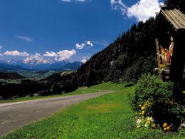
Around 26 stations with the most beautiful viewing points in the Garstner Valley show, how the landscape of the Pyhrn-Eisenwurzen has geologically developed in 250 million years. You also walk along the historical provisions path, along which provisions and iron were transported over the Hengstpass for hundreds of years and discover the tracks of the old iron road. The journey into the past starts at the railway station in Windischgarsten and leads to the "Geological Nature Trail" in the Nature Park. After the "Geological Nature Trail" with its display of stone, which make up the ground and constitute the mountains around Windischgarsten, you can carry on walking on the gravel banks of the dam stream and discover the stony witnessess of geological history for yourself. Past the Pistlmühle Sawmill and the Gasthaus Schaffelmühle after a little walk along the Rosenauer road to the confluence of the Frait stream, which you then follow. Towards Windischgarsten you leave the Fraitgraben and enjoy a wonderful view of the Garstner Valley. Passed a moor and over gentle moraine hills you return to the starting-point.Walking time: Path of Millions ca. 3-4 Std./with Proviantweg 6-7 Std
Path number: 10
Starting place: 4580 Windischgarsten
Destination: 4581 Rosenau am Hengstpaß
duration: 4h 38m
length: 15,1 km
Altitude difference (uphill): 538m
Altitude difference (downhill): 254m
Lowest point: 602m
Highest point: 972m
difficulty: medium
condition: medium
panoramic view: Some Views
Paths covering:
Asphalt, Gravel, Hiking trail
Starting point: Station Windischgarsten
Destination: Karlshütte on Hengstpaß
further information:
- Board possible
Details - hiking
- themed path
Accessibility / arrival
by car:
West motorway A1 - exit Voralpenkreuz on the A9 (Pyhrnautobahn) direction Graz - exit Roßleithen / Windischgarsten
by train:
Hauptbahnhof Linz - Windischgarsten
Graz - Selzthal - Windischgarsten
Most economical season
- Spring
- Summer
- Autumn
Please get in touch for more information.
Hauptstraße 28
4580 Windischgarsten
Phone +43 7562 5266 - 99
Fax machine +43 7562 5266 - 10
E-Mail info@pyhrn-priel.net
Web www.urlaubsregion-pyhrn-priel.at
https://www.urlaubsregion-pyhrn-priel.at


