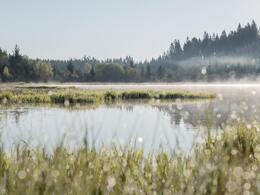
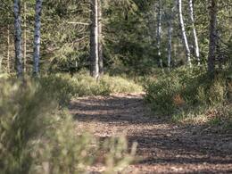
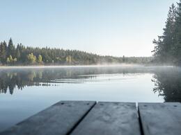
Naturschutzgebiet Tannermoor

Tannermoor nature reserve - moorland hiking trail
own signposting
Hikers have the opportunity to be accompanied through the moor by experienced mo orland guides, who will tell you everything you need to know and have many an interesting story or legend to tell. This tour is particularly recommended for hiking groups and school classes.
Information on moorland tours and appointment bookings can be made with the coordinator of the moorland tours, Mr Martin Groß (Tel. 0664 73044587, e-mail: grossmartin54@gmail.com), or directly with our moorland guides from Naturschauspiel.at:
- Hirner Silvia (Tel.: 0680 1472960 | silvia.hirner@outlook.com)
- Wansch Daniela (Tel.: 0676 5014926 | daniela.wansch@gmx.at)
- Wiesmüller Hermine (Tel.: 0664 3896686 | h.wiesmueller@gmx.at)
Paths covering:
further information:
- Flatly
- Board possible
Details - hiking
- themed path
All year round
by car:
Linz: A7 Mühlkreis motorway - B124 Königswiesener Straße - after Bad Zell turn left onto Schönauer Straße - turn left onto Riedmark Landesstraße
Vienna: via Krems an der Donau, Zwettl and Groß Gerungs
- Suitable for kids (3 - 14 Year)
- Spring
Please get in touch for more information.
4252 Liebenau
Phone +43 7953 8111
Fax machine +43 7953 8111 - 30
E-Mail office@muehlviertleralm.at
Web www.moorerlebnis.com/de/allgemein/
Web www.liebenau.at/Liebenau_erleben/To…
https://www.liebenau.at/Liebenau_erleben/Tourismus/Naturschutzgebiet_Tannermoor


