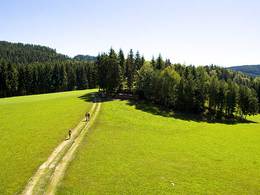
Kapellen- und Meditationsweg


Interactive elevation profile
Create PDF
Tour-Details
Starting place: 4173 St. Veit im Mühlkreis
Destination: 4173 St. Veit im Mühlkreis
duration: 2h 55m
length: 9,4 km
Altitude difference (uphill): 298m
Altitude difference (downhill): 292m
Lowest point: 563m
Highest point: 752m
difficulty: medium
condition: medium
panoramic view: Some Views
Paths covering:
Hiking trail
powered by TOURDATA
The path leads to many chapels and picture pillars and is also equipped with nine meditation boards.
* Shortcut: from the Wagner Chapel in a northerly direction on the old road over the mountain to St. Veit (saves approx. 1 hour walking time).
Most economical season
- Spring
- Summer
- Autumn
Please get in touch for more information.
Phone +43 7217 6055
E-Mail gemeinde@st-veit.ooe.gv.at
Web www.sanktveit.at
http://www.sanktveit.at
Interactive elevation profile
Create PDF
Tour-Details
Starting place: 4173 St. Veit im Mühlkreis
Destination: 4173 St. Veit im Mühlkreis
duration: 2h 55m
length: 9,4 km
Altitude difference (uphill): 298m
Altitude difference (downhill): 292m
Lowest point: 563m
Highest point: 752m
difficulty: medium
condition: medium
panoramic view: Some Views
Paths covering:
Hiking trail
powered by TOURDATA