

Von Enns nach Steyr


- pets allowed
- Suitable for families
- culinary interesting
- Possible accommodation
Interactive elevation profile
Create PDF
Tour-Details
Starting place: 4470 Enns
Destination: 4400 Steyr
duration: 1h 48m
length: 25,4 km
Altitude difference (uphill): 82m
Altitude difference (downhill): 40m
Lowest point: 250m
Highest point: 324m
difficulty: medium
condition: medium
panoramic view: Individual Views
Paths covering:
Asphalt, Path / trail, Gravel, Street, Hiking trail, Other
powered by TOURDATA
Short description:
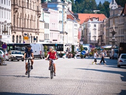
The northernmost section of the Enns Valley Cycle Path connects two of Upper Austria's most historic cities.
The northernmost section of the Enns Valley Cycle Path connects two of Upper Austria's most historic cities.
Recommended season:
- March
- April
- May
Properties:
- Refreshment stops available
- Family friendly
Route: Follow signs "Direction R1 Donauradweg" until Enghagen, then continue in the direction of R7 Ennstalradweg.
Directions:
After all, the roots of Enns go back to Roman times. From here, the bikes roll southward along the Enns River. The picturesque landscape is characterized by fields and meadows. The romantic town of Steyr with its more than thousand years of history lies at the mouth of the Steyr into the Enns. The destination of the tour is the Kleineder riding and pony farm in Christkindl.
Safety guidelines:
Find out in advance about any trail and road closures along the route!
Equipment:
Sun and rain protection, possibly repair kit for minor bike breakdowns.
Additional information:
You can obtain map material at www.steyr-nationalpark.at
Starting point: Enns
Destination: Christkindl bei Steyr
further information:
- culinary interesting
- Possible accommodation
- Board possible
- Pets allowed
- Suitable for single travelers
- Suitable for friends
- Suitable for couples
- Spring
Please get in touch for more information.
Stadtplatz 27
4400 Steyr
Phone +43 7252 53229 - 0
E-Mail info@steyr-nationalpark.at
Web www.steyr-nationalpark.at/
https://www.steyr-nationalpark.at/
Interactive elevation profile
Create PDF
Tour-Details
Starting place: 4470 Enns
Destination: 4400 Steyr
duration: 1h 48m
length: 25,4 km
Altitude difference (uphill): 82m
Altitude difference (downhill): 40m
Lowest point: 250m
Highest point: 324m
difficulty: medium
condition: medium
panoramic view: Individual Views
Paths covering:
Asphalt, Path / trail, Gravel, Street, Hiking trail, Other
powered by TOURDATA