Ibmer Moor Bike Path R25


- Suitable for families
Interactive elevation profile
Create PDF
Tour-Details
Path number: R25
Starting place: 5120 St. Pantaleon
Destination: 5122 Hochburg-Ach
duration: 2h 36m
length: 36,0 km
Altitude difference (uphill): 347m
Altitude difference (downhill): 298m
Lowest point: 384m
Highest point: 509m
difficulty: medium
condition: medium
panoramic view: Some Views
Paths covering:
Asphalt, Gravel, Street
powered by TOURDATA
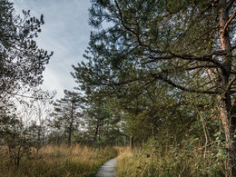
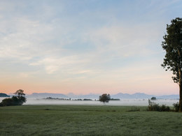
The Ibmer Moor Bike Path leads you through one of the most charming landscape highlights in Upper Austria.
Starting from the Tauern Bike path near Riedersbach, you ride across the Upper Innviertel Lake District. On the way to Ibm, you travel through Trimmelkam and Franking on Holzöster Lake. The Ibmer Moor itself is a unique moor landscape. After riding through the Weilhartsforst, you continue on to Hochburg and are re-united with the Tauern Bike Path near Aufhausen.
Starting from the Tauern Bike path near Riedersbach, you ride across the Upper Innviertel Lake District. On the way to Ibm, you travel through Trimmelkam and Franking on Holzöster Lake. The Ibmer Moor itself is a unique moor landscape. After riding through the Weilhartsforst, you continue on to Hochburg and are re-united with the Tauern Bike Path near Aufhausen.
Starting point: Town of Riedersbach on the Tauern Bike Path
Destination: Merging point with the Tauern Path near Hochburg-Ach
further information:
- Board possible
Accessibility / arrival
By car:
Coming from Linz/Vienna - A1 - exit Salzburg Nord - B 156 - take a left onto the Oberndorfer Landesstrasse until you reach Riedersbach
Most economical season
- Summer
Please get in touch for more information.
5120 St. Pantaleon
Phone +43 7722 62644
E-Mail info@entdeckerviertel.at
Interactive elevation profile
Create PDF
Tour-Details
Path number: R25
Starting place: 5120 St. Pantaleon
Destination: 5122 Hochburg-Ach
duration: 2h 36m
length: 36,0 km
Altitude difference (uphill): 347m
Altitude difference (downhill): 298m
Lowest point: 384m
Highest point: 509m
difficulty: medium
condition: medium
panoramic view: Some Views
Paths covering:
Asphalt, Gravel, Street
powered by TOURDATA


