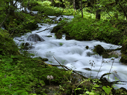
Theme trail Obertraun "Through Karst and Chalk"
Starting place: 4831 Obertraun
Destination: 4831 Obertraun
The 11 km long hiking trail around Obertraun tells of the eventful history of this landscape on 27 signposted adventure points.
The theme trail is also suitable as an extended running and Nordic walking trail. If you still have some time, we recommend a trip to the Dachstein Krippenstein to the Dachstein Giant Ice Cave, the 5fingers and the Dachstein Shark.
Phone number mountain rescue: 140
Experience the 360° Panorama Tour through Obertraun ...
Starting place: 4831 Obertraun
Destination: 4831 Obertraun
duration: 3h 14m
length: 11,1 km
Altitude difference (uphill): 263m
Altitude difference (downhill): 268m
Lowest point: 509m
Highest point: 627m
difficulty: very easy
condition: easy
panoramic view: Individual Views
Paths covering:
Hiking trail
Starting point: bathing area Obertraun
Destination: bathing area Obertraun
further information:
- Flatly
Details - hiking
- themed path
Accessibility / arrival
by car
- A1 motorway exit "Regau / Salzkammergut", from there via Bad Ischl and Hallstatt to Obertraun.
- Coming from the south on the A10 motorway, exit "Eben im Pongau". From there via Annaberg, Gosau and Hallstatt to Obertraun.
- On the highway B 145 via Bad Aussee to Obertraun.
- Parking at the parking lot of the beach Obertraun.
by train
- to train station "Obertraun Dachsteinhöhlen"
free
General price information
free of charge
- Suitable for groups
- Suitable for teenagers
- Suitable for seniors
- Suitable for single travelers
- Suitable for families
- Suitable for friends
- Suitable for couples
- Suitable for children
- Spring
- Summer
- Autumn
- Early winter
Please get in touch for more information.
Obertraun 180
4831 Obertraun
Phone +433 5 95095 - 40
E-Mail obertraun@dachstein-salzkammergut.at
Web www.dachstein-salzkammergut.at
http://www.dachstein-salzkammergut.at
You can also visit us on
Facebook Instagram Pinterest YouTube Wikipedia


